Event submissions
Published
This submission belongs to the session S7. Atmospheric Techniques, Instruments and Modeling of the event The 8th International Electronic Conference on Atmospheric Sciences
Published date
09 Oct, 2026
Academic Editor
'%3e%3cpath%20d='M12.6657%2010.9104C12.4185%2010.325%2012.0599%209.79327%2011.6097%209.34482C11.1609%208.89508%2010.6293%208.5365%2010.0442%208.28888C10.0389%208.28626%2010.0337%208.28495%2010.0285%208.28233C10.8446%207.69279%2011.3752%206.73249%2011.3752%205.64904C11.3752%203.8542%209.92103%202.39999%208.1262%202.39999C6.33136%202.39999%204.87715%203.8542%204.87715%205.64904C4.87715%206.73249%205.40774%207.69279%206.22393%208.28364C6.21869%208.28626%206.21345%208.28757%206.20821%208.29019C5.62129%208.5378%205.09463%208.89284%204.64265%209.34613C4.1929%209.79493%203.83432%2010.3266%203.58671%2010.9117C3.34345%2011.4845%203.21226%2012.0987%203.20023%2012.7209C3.19988%2012.7349%203.20233%2012.7488%203.20744%2012.7619C3.21255%2012.7749%203.22022%2012.7867%203.22998%2012.7968C3.23975%2012.8068%203.25142%2012.8147%203.26431%2012.8202C3.2772%2012.8256%203.29105%2012.8284%203.30504%2012.8284H4.09109C4.14874%2012.8284%204.19459%2012.7825%204.1959%2012.7262C4.2221%2011.7148%204.62823%2010.7676%205.34617%2010.0497C6.08899%209.30683%207.0755%208.89808%208.1262%208.89808C9.17689%208.89808%2010.1634%209.30683%2010.9062%2010.0497C11.6242%2010.7676%2012.0303%2011.7148%2012.0565%2012.7262C12.0578%2012.7838%2012.1037%2012.8284%2012.1613%2012.8284H12.9474C12.9613%2012.8284%2012.9752%2012.8256%2012.9881%2012.8202C13.001%2012.8147%2013.0126%2012.8068%2013.0224%2012.7968C13.0322%2012.7867%2013.0398%2012.7749%2013.0449%2012.7619C13.0501%2012.7488%2013.0525%2012.7349%2013.0522%2012.7209C13.0391%2012.0947%2012.9094%2011.4855%2012.6657%2010.9104ZM8.1262%207.9024C7.52486%207.9024%206.9589%207.6679%206.53312%207.24211C6.10733%206.81633%205.87283%206.25037%205.87283%205.64904C5.87283%205.0477%206.10733%204.48174%206.53312%204.05596C6.9589%203.63018%207.52486%203.39567%208.1262%203.39567C8.72753%203.39567%209.29349%203.63018%209.71927%204.05596C10.1451%204.48174%2010.3796%205.0477%2010.3796%205.64904C10.3796%206.25037%2010.1451%206.81633%209.71927%207.24211C9.29349%207.6679%208.72753%207.9024%208.1262%207.9024Z'%20fill='%235D1EE1'/%3e%3c/g%3e%3c/svg%3e) Chun Ho Liu
Chun Ho LiuCitation
Mateus Rodrigues Ferreira, Josef Augusto Oberdan Souza Silva, Henrique Fonseca Elias de Oliveira, Antonio Evami Cavalcante Sousa, Marcos Vinícius da Silva, Sisgo Rachith Acuña Chinchilla, Jhon Lennon Bezerra da Silva, Ailton Alves de Carvalho, Spatiotemporal Dynamics of Land Use and Land Cover in the Brazilian Cerrado (1985–2023): Climatic and Anthropogenic Pressures, Water Impacts, and Implications for Conservation, in Proceedings of The 8th International Electronic Conference on Atmospheric Sciences, 14 October–16 October 2026, MDPI: Basel, Switzerland
Share
Email
Facebook
Twitter
LinkedIn
Spatiotemporal Dynamics of Land Use and Land Cover in the Brazilian Cerrado (1985–2023): Climatic and Anthropogenic Pressures, Water Impacts, and Implications for Conservation
'%3e%3cpath%20d='M12.6647%2010.9104C12.4176%2010.325%2012.0589%209.7933%2011.6088%209.34485C11.16%208.89511%2010.6283%208.53653%2010.0432%208.28891C10.038%208.28629%2010.0327%208.28498%2010.0275%208.28236C10.8437%207.69282%2011.3743%206.73252%2011.3743%205.64907C11.3743%203.85423%209.92005%202.40002%208.12522%202.40002C6.33038%202.40002%204.87618%203.85423%204.87618%205.64907C4.87618%206.73252%205.40677%207.69282%206.22296%208.28367C6.21772%208.28629%206.21248%208.2876%206.20724%208.29022C5.62031%208.53783%205.09365%208.89287%204.64167%209.34616C4.19192%209.79496%203.83334%2010.3266%203.58573%2010.9117C3.34247%2011.4846%203.21128%2012.0987%203.19925%2012.721C3.1989%2012.735%203.20135%2012.7489%203.20646%2012.7619C3.21157%2012.7749%203.21924%2012.7868%203.22901%2012.7968C3.23877%2012.8068%203.25045%2012.8148%203.26334%2012.8202C3.27623%2012.8256%203.29007%2012.8284%203.30406%2012.8284H4.09012C4.14776%2012.8284%204.19362%2012.7825%204.19493%2012.7262C4.22113%2011.7148%204.62726%2010.7676%205.34519%2010.0497C6.08802%209.30686%207.07452%208.89811%208.12522%208.89811C9.17592%208.89811%2010.1624%209.30686%2010.9052%2010.0497C11.6232%2010.7676%2012.0293%2011.7148%2012.0555%2012.7262C12.0568%2012.7839%2012.1027%2012.8284%2012.1603%2012.8284H12.9464C12.9604%2012.8284%2012.9742%2012.8256%2012.9871%2012.8202C13%2012.8148%2013.0117%2012.8068%2013.0214%2012.7968C13.0312%2012.7868%2013.0389%2012.7749%2013.044%2012.7619C13.0491%2012.7489%2013.0515%2012.735%2013.0512%2012.721C13.0381%2012.0947%2012.9084%2011.4856%2012.6647%2010.9104ZM8.12522%207.90243C7.52388%207.90243%206.95792%207.66793%206.53214%207.24215C6.10636%206.81636%205.87185%206.2504%205.87185%205.64907C5.87185%205.04773%206.10636%204.48177%206.53214%204.05599C6.95792%203.63021%207.52388%203.3957%208.12522%203.3957C8.72655%203.3957%209.29252%203.63021%209.7183%204.05599C10.1441%204.48177%2010.3786%205.04773%2010.3786%205.64907C10.3786%206.2504%2010.1441%206.81636%209.7183%207.24215C9.29252%207.66793%208.72655%207.90243%208.12522%207.90243Z'%20fill='%235D1EE1'/%3e%3c/g%3e%3c/svg%3e)
Mateus Rodrigues Ferreira 1
Josef Augusto Oberdan Souza Silva 2

Henrique Fonseca Elias de Oliveira 1
Antonio Evami Cavalcante Sousa 3

Marcos Vinícius da Silva 4
Sisgo Rachith Acuña Chinchilla 5

Jhon Lennon Bezerra da Silva 3
Ailton Alves de Carvalho 6
1. Cerrado Irrigation Graduate Program, Goiano Federal Institute - Campus Ceres, GO-154, km 218 - Zona Rural, Ceres 76303899, Brazil.
2. Federal University of Pelotas, Rua Gomes Carneiro, 1, Centro, Pelotas, Rio Grande do Sul, 96010610, Brazil.
3. Cerrado Irrigation Graduate Program, Goiano Federal Institute - Campus Ceres, GO-154, km 218 - Zona Rural, Ceres 76300000, Brazil.
4. Chapadinha Science Center, Federal University of Maranhão, Chapadinha, Maranhão, 65500-000, Brazil.
5. Faculty of Agri-Food Sciences, University of Costa Rica, San José, Costa Rica
6. Agricultural Engineering, Federal Rural University of Pernambuco, Recife, Brazil
Abstract
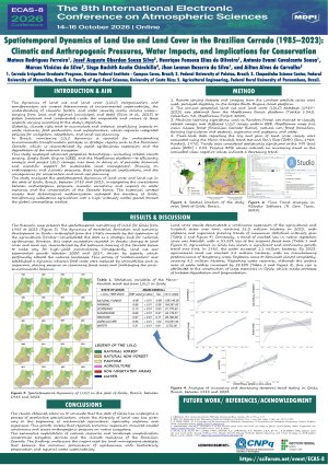
Introduction: This research analyzes the spatiotemporal dynamics of land cover and land use in the state of Goiás, Brazil, between 1985 and 2023, investigating the correlations between anthropogenic pressures, climatic variations, and the impacts on water resources and the conservation of the Cerrado biome. The historical analysis reveals that technological modernization reconfigured the territory of Goiás, transforming subsistence agriculture into a high-intensity model geared toward the global commodities market. Methods: Remote sensing datasets and images from the Landsat satellite series (NASA/USGS) were used, processed digitally in the Google Earth Engine cloud. The pixel-by-pixel data, showing the loss and gain of coverage classes, were validated using the Mann-Kendall and Sen's Slope trend tests, at a 99% confidence level. Results: Land cover results demonstrate a continuous expansion of the agricultural and livestock class over time, reaching 21.3 million hectares in 2023, with soybeans and sugarcane showing trends of maximum statistical intensity gain (Tau = 1.00; p-value = 0.01). Conversely, a sharp trend of loss of native vegetation cover was detected, with a loss of 31.55% of the original forest area (Tau = −1.00; p-value = 0.01). The savanna formation proved to be the most vulnerable, exhibiting a clearing rate 7.3 times higher than that of the forest formation. In the water context, although the surface area of water bodies has grown by 58.88% (Tau = 0.62; p-value = 0.01), this increase is attributed to the construction of large reservoirs in Goiás, which masks processes of habitat degradation and fragmentation. Conclusion: The analysis concludes that the exhaustive exploitation of natural resources and the simplification of the landscape compromise ecosystem services and the climate resilience of the Brazilian Cerrado. The findings underscore the urgent need for territorial management strategies that balance the economic prominence of agribusiness with biodiversity preservation and regional water sustainability.
Keywords
Brazilian Cerrado
Agribusiness
Water resources
Remote sensing
Temporal trend analysis.
Poster
Sciforum-206058.pdf
Defining the Startup Time for Forecasting the PM2.5 Levels Due to the New Year Combustion Activities in an Urban Andean City of Southern Ecuador
Neural equalization for bit-error mitigation in atmospheric optical downlinks: implications for remote sensing instrument data integrity