Event submissions
Published
This submission belongs to the session S8. Emerging Applications of Drones of the event Drones 2026: Mapping the Knowledge
Published date
12 Nov, 2026
Citation
Edilson Souza Bias, João Paulo Lopes Cunha, ARCHEOLOGICAL MAPPING WITH REMOTELY PILOTED AIRCRAFT - ACQUISITION OF LARGE-SCALE FEATURES, in Proceedings of Drones 2026: Mapping the Knowledge, Barcelona, 11 November–13 November 2026, MDPI: Basel, Switzerland
Share
Email
Facebook
Twitter
LinkedIn
ARCHEOLOGICAL MAPPING WITH REMOTELY PILOTED AIRCRAFT - ACQUISITION OF LARGE-SCALE FEATURES

Edilson Souza Bias 1
João Paulo Lopes Cunha 1
1. University of Brasilia
Abstract
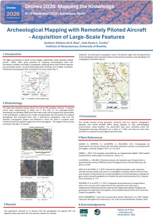
The digital processing of aerial survey images, specifically using remotely piloted aircraft (RPA), offers great potential for mapping archaeological sites with inscriptions, whether paintings or petroglyphs. Mapping these environments requires sub-centimeter detail, accommodates geometric diversity, and is highly vulnerable. The Bisnau Archaeological Site is located in Formosa, Goiás. The data were obtained using a Mavic Pro and an RTK geodetic receiver. 11 support points were implemented: 6 GCPs (Ground Control Points) and 5 CPs (Check Points). The GCPs were randomly placed along the edge of the archaeological panel surface, with one used as a takeoff point, and the CP points were identified internally based on the petroglyph inscriptions. For photogrammetric processing, the software PIX4D and Orfeo were used, and to support the vectorization of the petroglyphs, a digital terrain model was generated. We interpreted the mapped petroglyphs and compared them with a planimetric topographic map from the Brazilian Cartographic System and Stellarium, which we used to compare solar movement with the apparent alignment of the petroglyphs. This application allowed us to observe that the petroglyphs are aligned with the apparent solar movement from the summer solstice for the year 5,650 B.C. Comparing the topographic map of the Bisnau region with the geometries of the petroglyphs demonstrated evidence that primitive peoples used petroglyphs for cartographic orientation. The results showed strong geometric similarity with the region's cartographic features. The results showed ARP's strong capacity to map archaeological environments. Using GeoPEC, the planimetric data were classified under the Cartographic Accuracy Standard-A at a scale of 1:1000, and they are more than sufficient to represent the petroglyphs geometrically.
Keywords
Remotely Piloted Aircraft
Archeological
Petroglyphs
Bisnau
Poster
Poster Edilson - Bisnau.pdf
Data-Efficient Field-Scale Mapping of Soil Salinity and Its Spatial Controls Using UAV Multispectral Imagery, Proximal Sensing, and Interpretable Machine Learning
From UAV Data Acquisition to Decision-Led Geospatial Monitoring: Stakeholder Perspectives from Scottish Peatland Restoration