Event submissions
Published
This submission belongs to the session S5. Drones in Rangelands, Agriculture, and Forestry of the event Drones 2026: Mapping the Knowledge
Published date
12 Nov, 2026
Citation
Edilson Souza Bias, Denilson Pereira Passo, Rodrigo Rodrigues Antunes, Raul Queiroz Feitosa, Gilson Alexandre Ostwald Pedro Costa, Thanan Walesza Pequeno Rodrigues, Application of RPA and AI in the Identification of Pests in Cotton Plantations in the Brazilian Cerrado, in Proceedings of Drones 2026: Mapping the Knowledge, Barcelona, 11 November–13 November 2026, MDPI: Basel, Switzerland
Share
Email
Facebook
Twitter
LinkedIn
Application of RPA and AI in the Identification of Pests in Cotton Plantations in the Brazilian Cerrado

Edilson Souza Bias 1
Denilson Pereira Passo 1
Rodrigo Rodrigues Antunes 1

Raul Queiroz Feitosa 2

Gilson Alexandre Ostwald Pedro Costa 3

Thanan Walesza Pequeno Rodrigues 4
1. University of Brasilia
2. PUC-Rio
3. UERJ
4. Federal Institute of Brasília
Abstract
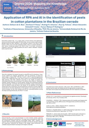
Amaranthus palmeri is a weed in North America that significantly reduces productivity, grows rapidly (25–50mm/day), and produces approximately 500,000 seeds/plant. In Brazil, it was detected in Mato Grosso in 2015. It is now found in other states, threatening soybean and cotton crops. Conventional inspection cannot cover large areas. To address this challenge, the research focused on using RPA and AI to develop an "open source" platform to map, identify, and monitor crops. To obtain the data, a Matrice 350 – RTK, a DJI P1 aerial photogrammetry camera, and a GNSS DA 2 were used. Two data collection stages were carried out to monitor the phenological process. The images were pre-processed with the software "Metashape." The samples were used to train a neural network, and processing was carried out with the GeoLearning plugin; finally, testing and validation were conducted on areas not used for training to avoid bias in the results. For the final flight adjustments, several tests were conducted to obtain the best image, given weed size and possible mixing with other species. Among the Deep Learning architectures, YOLO 11 was used. GeoLearning was developed in three main modules: sample collection, training, application, and detection. The plugin was built in PyQt 5 and integrated into QGIS using GDAL, Ultralytics, and OpenCV. After developing and testing GeoLearning and collecting samples, the researchers trained the model on Google Colab. The performance metrics (precision—95%, recall—93%, and MAP @ 0.5—99%) showed that the model can reliably identify the target species and generate a final report that includes the identified elements with their respective coordinates.
Keywords
Amaranthus palmeri
Deep Learning
YOLO
GeoLearning
Poster
Poster Edilson - Amaranthus palmeri.pdf
From UAV Data Acquisition to Decision-Led Geospatial Monitoring: Stakeholder Perspectives from Scottish Peatland Restoration
Deep Learning-Based Detection of Paint Peeling: An Evaluation of CNN Architectures for Automated Building Inspections