Event submissions
Published
This submission belongs to the session S5. Drones in Rangelands, Agriculture, and Forestry of the event Drones 2026: Mapping the Knowledge
Published date
12 Nov, 2026
Contribution&Funding
Conceptualization,
[Giacomo Quattrini] ; [Simone Pesaresi] ; [Adriano Mancini] ; [Simona Casavecchia]
Methodology,
[Giacomo Quattrini] ; [Simone Pesaresi] ; [Lara Lucchetti] ; [Nicole Hofmann] ; [Adriano Mancini]
Validation,
[Nicole Hofmann] ; [Adriano Mancini] ; [Lara Lucchetti] ; [Simona Casavecchia]
Formal analysis,
[Giacomo Quattrini] ; [Simone Pesaresi]
Writing - original draft,
[Giacomo Quattrini] ; [Simone Pesaresi]
Writing - review,
[editing] ; [Adriano Mancini] ; [Nicole Hofmann] ; [Lara Lucchetti] ; [Simona Casavecchia] ; [Simone Pesaresi]
Supervision,
[Simone Pesaresi]
Funding: --
Citation
Giacomo Quattrini, Adriano Mancini, Nicole Hofmann, Lara Lucchetti, Mattia Camilletti, Simona Casavecchia, Simone Pesaresi, High-Resolution Optical-Zoom Drone Imagery for the First Quantitative Estimate of Euphorbia dendroides in a Coastal Cliff Sector of Monte Conero, in Proceedings of Drones 2026: Mapping the Knowledge, Barcelona, 11 November–13 November 2026, MDPI: Basel, Switzerland
Share
Email
Facebook
Twitter
LinkedIn
High-Resolution Optical-Zoom Drone Imagery for the First Quantitative Estimate of Euphorbia dendroides in a Coastal Cliff Sector of Monte Conero

Giacomo Quattrini 1
Adriano Mancini 2
Nicole Hofmann 1
Lara Lucchetti 1
Mattia Camilletti 1
Simona Casavecchia 1
Simone Pesaresi 1
1. Department of Agricultural, Food and Environmental Sciences (D3A), Università Politecnica delle Marche, Ancona, 60131, Italy
2. Department of Information Engineering (DII), Università Politecnica delle Marche, Ancona, 60131, Italy
Abstract
Coastal cliffs remain among the least investigated terrestrial environments because steep slopes, instability and limited accessibility strongly constrain conventional vegetation surveys. As a consequence, ecologically and biogeographically relevant plant populations may be known only through presence records, with little quantitative information on their abundance and spatial distribution. This is the case of Euphorbia dendroides L. at Monte Conero, where the species occurs near the northern limit of its Adriatic distribution range on largely inaccessible calcareous cliffs.
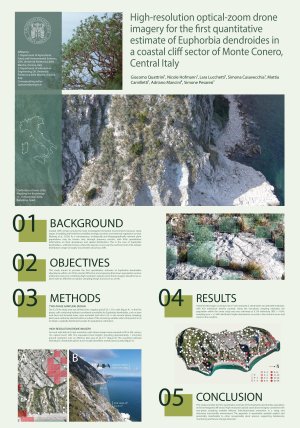
This study provides the first quantitative estimate of this population by combining high-resolution optical-zoom drone imagery with a two-phase sampling design over a 23.78 ha coastal cliff sector. In the first phase, the area was divided into 25 × 25 m cells and screened to identify those potentially suitable for E. dendroides. In the second phase, sampling plots were selected within these cells to obtain a spatially distributed sample used for population estimation. Nadir images were acquired from 90 m using a 16× optical zoom (405 mm equivalent focal length), with a ground sampling distance of approximately 1 mm pixel. Each analysed image represented 44.3 m², allowing individual plants to be visually identified and counted.
A total of 206 images covering 9,126 m² were analysed. E. dendroides was detected in 80 plots, with 420 individuals directly counted. Using the two-phase sampling estimator, the population within the entire study area was estimated at 9,154 individuals (RSE = 14.9%; sampling error = ±1,364 individuals). Higher abundances occurred in the northern sector and closer to the coastline.
These results show that high-resolution optical-zoom drone imagery combined with targeted two-phase sampling enables individual-based population estimates in steep and inaccessible environments. The approach is repeatable, spatially explicit and potentially transferable to other plant species recognizable from high-resolution imagery, providing a flexible framework for biodiversity monitoring and future change detection.
Keywords
remote sensing
high-resolution drone imagery
drone monitoring
plant population estimation
biodiversity monitoring
Poster
Poster_Barcellona_GiacomoQuattrini_res.pdf
Quantifying phenological changes and invasions of Rosa bracteata cover on Southeast Texas rangelands
APPLICATION OF UAS-BASED RGB IMAGING FOR HIGH-THROUGHPUT MAIZE PLANT HEIGHT PHENOTYPING