Event submissions
Published
This submission belongs to the session S5. Drones in Rangelands, Agriculture, and Forestry of the event Drones 2026: Mapping the Knowledge
Published date
12 Nov, 2026
Contribution&Funding
Conceptualization,
[Ella Mulkerrins]
Methodology,
[Ella Mulkerrins]
Software,
[Ella Mulkerrins]
Validation,
[Ella Mulkerrins]
Formal analysis,
[Ella Mulkerrins]
Investigation,
[Ella Mulkerrins]
Resources,
[Ella Mulkerrins]
Data curation,
[Ella Mulkerrins]
Writing - original draft,
[Ella Mulkerrins]
Writing - review,
[editing] ; [Sarah Walsh]
Visualization,
[Ella Mulkerrins]
Supervision,
[Sarah Walsh] ; [Michael O'Donovan] ; [Jack McDonnell] ; [Joseph P Lynch]
Funding: --
Citation
Ella Mulkerrins, Sarah Walsh, Michael O'Donovan, Jack McDonnell, Joseph P Lynch, Predictive performance of a machine learning model for plot-level dry matter yield estimation using drone derived multispectral indices., in Proceedings of Drones 2026: Mapping the Knowledge, Barcelona, 11 November–13 November 2026, MDPI: Basel, Switzerland
Share
Email
Facebook
Twitter
LinkedIn
Predictive performance of a machine learning model for plot-level dry matter yield estimation using drone derived multispectral indices.

Ella Mulkerrins 1,2
Sarah Walsh 1

Michael O'Donovan 1
Jack McDonnell 2
Joseph P Lynch 2
1. Animal and Grassland Research and Innovation Centre, Teagasc, Cork, Ireland
2. Centre for Freshwater and Environmental Studies, Dundalk Institute of Technology, Dundalk, Ireland
Abstract
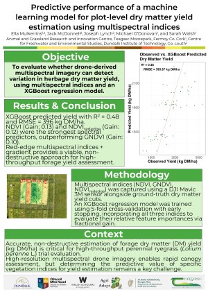
Accurate and non-destructive herbage mass estimation has significant potential for both commercial farm management and research applications. High resolution drone imagery can potentially provide an avenue to estimate herbage yield through the collection of multispectral data. However, optimising the use of multispectral vegetation indices remains a key challenge. This study evaluated the performance of an XGBoost gradient boosting framework incorporating multiple multispectral vegetation indices to predict plot-scale dry matter yield (kg DM/ha) in perennial ryegrass (Lolium perenne L.).
Imagery was captured across plot trials using a DJI Mavic 3M multispectral sensor. The following spectral vegetation indices were calculated from the imagery; Normalised Difference Vegetation Index (NDVI), Green Normalised Difference Vegetation Index (GNDVI), and Normalised Difference Vegetation Index Red-Edge (NDVIre), alongside actual measured plot level dry matter yield (kg DM/ha). An XGBoost regression model was trained using 5-fold cross-validation with early stopping. Feature importances were calculated using fractional gain.
The XGBoost model predicted plot dry matter yield with an R2 of 0.48, and a Root Mean Square Error of 395.87 kg DM/ha. The trial accounted for significant baseline variation, while NDVI (Gain: 0.133) and NDVIre (Gain: 0.115) provided the highest relative predictive contribution among spectral features, outperforming GNDVI (Gain: 0.102).
Combining multispectral indices with gradient boosting provides a viable workflow for dry matter yield estimation, offering an efficient methodology for high-throughput assessment.
Keywords
Remote Sensing
Dry Matter Yield
Multispectral Indices
Perennial Ryegrass
XGBoost Regression Model
Poster
A0-Drones26 _final.pdf
APPLICATION OF UAS-BASED RGB IMAGING FOR HIGH-THROUGHPUT MAIZE PLANT HEIGHT PHENOTYPING
Water Spray Efficiency of UAV-Scale Aerial Firefighting under Crosswind Conditions: An FDS-Based Dimensionless Analysis for Operational Design