Event submissions
Published
This submission belongs to the session S5. Drones in Rangelands, Agriculture, and Forestry of the event Drones 2026: Mapping the Knowledge
Published date
12 Nov, 2026
Citation
Diana Carolina Polanía Montiel, Luis Manuel Navas Gracia, AQUILES ENRIQUE DARGHAN, Igor Araújo Barbosa, Daniel Marçal De Queiroz, Bitemporal Integration of Spectral Indices Obtained from UAS–Sentinel-2 Images for the Estimation and Spatial Analysis of Maize Yield, in Proceedings of Drones 2026: Mapping the Knowledge, Barcelona, 11 November–13 November 2026, MDPI: Basel, Switzerland
Share
Email
Facebook
Twitter
LinkedIn
Bitemporal Integration of Spectral Indices Obtained from UAS–Sentinel-2 Images for the Estimation and Spatial Analysis of Maize Yield

Diana Carolina Polanía Montiel 1

Luis Manuel Navas Gracia 1
AQUILES ENRIQUE DARGHAN 2
Igor Araújo Barbosa 3
Daniel Marçal De Queiroz 3
1. Agricultural and Forestry Engineering, University of Valladolid, Palencia, 34004, Spain
2. Agronomy, National University of Colombia, Bogota, Colombia
3. Agricultural Engineering, Federal University of Viçosa, Viçosa (Minas Gerais), 36.570-900, Brazil
Abstract
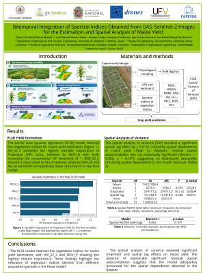
Yield estimation through remote sensing is a valuable tool to support agricultural decision-making; however, spatiotemporal canopy heterogeneity can limit model accuracy and affect statistical inference when spatial dependence exists. This study aimed to estimate maize (Zea mays L.) yield through vegetation indices obtained from Sentinel-2 images and unmanned aircraft systems (UASs), integrating information from two growing seasons with different agronomic management. This observational study included two maize genotypes, Maxeed and Darkness, and two preceding crops: maize and sugar beet. Because the original yield was assigned at a spatial scale larger than the sampling units, several observations had identical values, preventing adequate representation of point-to-point spatial variability. To address this limitation, a partial least squares regression model was fitted using vegetation indices derived from 2023 satellite images and from 2024 satellite and UAS images, considering only the R1 reproductive phenological stage. The final model retained five indices, highlighting the UAS-derived Normalized Difference Vegetation Index for the current growing season and the satellite-derived Advanced Vegetation Index for the previous growing season. Subsequently, a spatial analysis of variance with a selective spatial lag term was applied to the estimated yield. Maxeed presented a higher mean yield than Darkness (12,488 kg/ha versus 10,831 kg/ha; approximately 15% higher), with statistical evidence of differences between genotypes. Incorporating the spatial component eliminated the residual autocorrelation initially detected. The methodology integrated two technologies and two growing seasons to compare genotypes under different preceding crops. The estimated yield was higher when the preceding crop was sugar beet, with increases of 21.7% for Maxeed and 4.6% for Darkness compared with conditions preceded by maize.
Keywords
Precision agriculture; Multisensor data fusion; Remote sensing; Partial least squares regression; Crop rotation.
Poster
Poster_2.pdf
Water Spray Efficiency of UAV-Scale Aerial Firefighting under Crosswind Conditions: An FDS-Based Dimensionless Analysis for Operational Design
Landscape-Level Forage Estimation Using Fine-Scale Drone Imagery in Rangelands