Event submissions
Published
This submission belongs to the session S5. Drones in Rangelands, Agriculture, and Forestry of the event Drones 2026: Mapping the Knowledge
Published date
12 Nov, 2026
Citation
Igor Araújo Barbosa , Daniel Marçal De Queiroz, Diana Carolina Polanía Montiel, Luis Manuel Navas Gracia, Radiometric Correction of UAV Multispectral Imagery Under Variable Illumination using a Single Calibrated Reflectance Panel, in Proceedings of Drones 2026: Mapping the Knowledge, Barcelona, 11 November–13 November 2026, MDPI: Basel, Switzerland
Share
Email
Facebook
Twitter
LinkedIn
Radiometric Correction of UAV Multispectral Imagery Under Variable Illumination using a Single Calibrated Reflectance Panel

Igor Araújo Barbosa 1
Daniel Marçal De Queiroz 1
Diana Carolina Polanía Montiel 2,3

Luis Manuel Navas Gracia 2,3
1. Agricultural Engineering, Federal University of Viçosa, Viçosa (Minas Gerais), 36.570-900 , Brazil
2. Department of Agricultural and Forestry Engineering, University of Valladolid , Palencia, 34004, Spain
3. Agricultural and Forestry Engineering, University of Valladolid, Palencia, 34004, Spain
Abstract
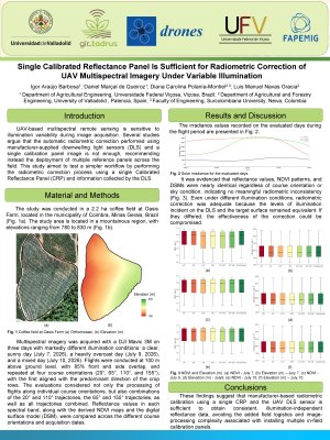
UAV-based multispectral remote sensing is sensitive to illumination variability during image acquisition. Several studies argue that the automatic radiometric correction performed using manufacturer-supplied downwelling light sensors (DLSs) and a single calibration panel image is insufficient, recommending instead the deployment of multiple reference panels across the field. This study tested that recommendation by evaluating a simpler workflow relying solely on the standard calibration system, a single MicaSense Calibrated Reflectance Panel (CRP) imaged before and after each flight. Multispectral imagery was acquired with a DJI Mavic 3M over a 2.2 ha coffee field at Oasis Farm, Coimbra, Minas Gerais, Brazil, on three days with markedly different illumination: a clear, sunny day (July 7, 2026), a heavily overcast day (July 9, 2026), and a mixed day that began clear and grew increasingly cloudy (July 10, 2026). Flights were conducted at 100 m above ground level with 85% front and side overlap, and repeated at four course orientations (20°, 65°, 110°, and 155°), the first aligned with the dominant crop row direction, to evaluate possible interactions between flight-line geometry and illumination. Reflectance values in each spectral band, along with derived NDVI maps and the digital surface model (DSM), were compared across course angles and acquisition dates. Results showed nearly identical reflectance values, NDVI patterns, and DSMs regardless of course orientation or sky condition, indicating no meaningful radiometric inconsistency. These findings suggest that manufacturer-based radiometric calibration using a single CRP and the UAV DLS sensor is sufficient to obtain consistent, illumination-independent reflectance data, avoiding the added field logistics and image-processing complexity associated with installing multiple in-field calibration panels.
Keywords
UAV multispectral imagery
Radiometric calibration
Calibrated Reflectance Panel (CRP)
Illumination variability
Poster
Poster_1.pdf
Toward Decision-Conditioned Credibility for an Unvalidatable UAS Acoustic-Disturbance Digital Twin
Definition of U-plan 4D volumes and their impact on flight authorisation and airspace capacity