Event submissions
Published
This submission belongs to the session S3. Guidance, Navigation, and Control of the event Drones 2026: Mapping the Knowledge
Published date
12 Nov, 2026
Citation
Mustapha Amine Sadi, Jerome Jouffroy, On real-time boresight estimation for UAV-based antenna measurements: a hybrid model approach., in Proceedings of Drones 2026: Mapping the Knowledge, Barcelona, 11 November–13 November 2026, MDPI: Basel, Switzerland
Share
Email
Facebook
Twitter
LinkedIn
On real-time boresight estimation for UAV-based antenna measurements: a hybrid model approach.

Mustapha Amine Sadi 1
Jerome Jouffroy 2
1. The Faculty of Engineering
Institute of Mechanical and Electrical Engineering
SDU Mechatronics (CIM)
University of Southern Denmark
2. SDU Mechatronics / Center for Industrial Mechanics (CIM)
Department of Mechanical and Electrical Engineering (DME)
University of Southern Denmark
Abstract
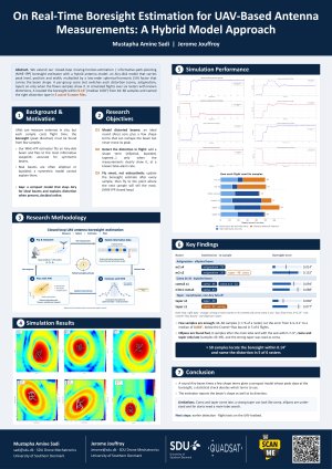
UAV-based antenna measurements offer a flexible alternative to conventional antenna far-field measurements, but a misalignment with respect to the boresight position can lead to uncentered data files, possibly needing a new round of measurements. Extending our previous work, where we introduced a closed-loop framework combining Moving Horizon Estimation (MHE) with Fisher Information Matrix (FIM)-based Informative Path Planning (IPP) for real-time boresight estimation, this paper extends that framework to non-ideal antenna patterns by introducing a hybrid modelling approach that augments an Airy main-lobe model with low-order spherical harmonic corrections, thus capturing beam deformation and asymmetry. Our estimator, whose IPP part guides the UAV in real-time, starts from the Airy model and activates the additional correction terms online only when the measurements indicate that the circular model is no longer sufficient. The MHE is used to estimate the boresight from sequential UAV measurements integrating physical constraints, while IPP is done using FIM-based greedy D-optimal planning in order for the UAV to select the next waypoint maximizing information gain. This preserves the real-time closed-loop structure of the original method while improving robustness to non-symmetric main lobes. Conventional UAV antenna raster scan typically requires on the order of 2000–5000 sampled points, whereas the proposed closed-loop approach is able boresight estimation within about 40–60 informative measurements depending on pattern complexity. Validation on deformed patterns derived from actual UAV raster measurements show accurate boresight estimation with stable convergence, demonstrating that the method extends efficient adaptive localization beyond the ideal symmetric-beam case.
Keywords
UAV
boresight estimation
moving horizon estimation
path planning
Fisher infromation matrix
D-optimal greedy algorithm
spherical harmonics
non-symmetric antenna pattern
Poster
poster_A0_conference.pdf
On the Energy Trade-offs of Continuous vs. Locked Rotor Tilt Control in Tiltrotor Quadcopters
Ultra-Wideband Localization in Forest Environments: Potential for Drone Applications