Event submissions
Published
This submission belongs to the session S3. Guidance, Navigation, and Control of the event Drones 2026: Mapping the Knowledge
Published date
12 Nov, 2026
Contribution&Funding
Methodology,
[Zuoya Liu]
Validation,
[Zuoya Liu] ; [Harri Kaartinen]
Resources,
[Harri Kaartinen]
Data curation,
[Zuoya Liu] ; [Harri Kaartinen]
Writing - original draft,
[Zuoya Liu]
Supervision,
[Harri Kaartinen]
Project administration,
[Zuoya Liu]
Funding acquisition,
[Zuoya Liu]
Funding: Academy Research Fellowships through the project EATP4Plots (No. 368564), funded by Research Council of Finland RCF.
Citation
Zuoya Liu, Harri Kaartinen, Ultra-Wideband Localization in Forest Environments: Potential for Drone Applications, in Proceedings of Drones 2026: Mapping the Knowledge, Barcelona, 11 November–13 November 2026, MDPI: Basel, Switzerland
Share
Email
Facebook
Twitter
LinkedIn
Ultra-Wideband Localization in Forest Environments: Potential for Drone Applications

Zuoya Liu 1

Harri Kaartinen 1
1. Remote Sensing and Photogrammetry , Finnish Geospatial Research Institute (FGI), Espoo, Finland, 02150, Finland
Abstract
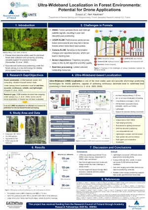
Recently, drones integrated with advanced remote sensing technologies such as GNSS, laser scanning, and cameras have been widely used in forest environments to collect forest data both manually and autonomously. However, as GNSS accuracy is usually poor under forest canopies and GNSS signals are often discontinuous and interrupted by forest canopies, high-performance SLAM algorithms based on laser scanning or camera and IMU data are usually used for navigation and localization of drones in forests. The major challenge with SLAM-based solutions is that their performance varies considerably across different forest environments. For example, laser scanning-based SLAM algorithms might fail in dense forests due to the obstruction of laser pulses by trees. As a result, SLAM technology relies heavily on the algorithm itself as well as the performance of IMU sensors used for reliable trajectory estimation.
Ultra-wideband (UWB) localization, as one of the most popular and accurate close-range positioning technologies for moving platforms, has been widely used in drone applications in indoor environments over the past decade to provide high-precision and large-scale positioning solutions. In addition to localization, UWB technology also provides communication capability between devices, making it suitable for drone swarm applications. Moreover, UWB devices are able to form a network precisely and autonomously based only on the ranging measurements between them, making UWB suitable for use in forest environments to overcome the limitations of GNSS. Our preliminary results show that decimeter-level positioning accuracy can be achieved by standalone UWB localization in a forest environment without prior knowledge of the UWB beacons or their positions. All UWB devices can be deployed randomly, and they can be rapidly and precisely discovered and included in the same local network. Therefore, UWB localization has great potential for drone applications in forests.
Keywords
Drone
ultra-wideband localization
communication
autonomous navigation
forest.
Poster
Ultra-Wideband Localization in Forest Environments Potential for Drone Applications.pdf
On real-time boresight estimation for UAV-based antenna measurements: a hybrid model approach.
Sea-Trial Validation of ANFIS-Based Energy-Efficient Pitch Control for a Buoyancy-Driven Underwater Drone