Event submissions
Published
This submission belongs to the session S6. Drones in Security and Defense of the event Drones 2026: Mapping the Knowledge
Published date
12 Nov, 2026
Citation
Carlos S. Álvarez-Merino, Juan Bravo Arrabal, Mengting Li, Rocio Rodriguez Cano, Anders Lyhne Christensen, Jan H. Mikkelsen, Active Antenna-Aware UAV Navigation for Real-Time RF Mapping and Source Localization, in Proceedings of Drones 2026: Mapping the Knowledge, Barcelona, 11 November–13 November 2026, MDPI: Basel, Switzerland
Share
Email
Facebook
Twitter
LinkedIn
Active Antenna-Aware UAV Navigation for Real-Time RF Mapping and Source Localization

Carlos S. Álvarez-Merino 1
Juan Bravo Arrabal 2
Mengting Li 1
Rocio Rodriguez Cano 1

Anders Lyhne Christensen 3
Jan H. Mikkelsen 1
1. Antennas,Propagation, and Millimetre-Wave Systems, Aalborg University, 9000, Denmark
2. Postdoctoral Researcher, SDU UAS Center
MMMI, 5230 Odense M, Denmark | Ø19-608-0, Building II
3. Full Professor, SDU UAS Center
MMMI, 5230 Odense M, Denmark | Ø19-608-0, Building II
Abstract
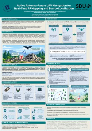
Search-and-rescue (SAR) operations increasingly employ UAVs in environments where optical and thermal sensing may be degraded by vegetation, debris, smoke, or structural obstruction. Radio-frequency (RF) localization provides a complementary approach when a victim or target carries a cooperative wireless device. This work presents an ongoing implementation of an active UAV-based RF localization framework in which the UAV is treated as an adaptive sensing platform rather than as a passive carrier following a predefined trajectory.
The proposed approach follows a measure–estimate–move strategy. RF ranging measurements are combined with UAV pose information to iteratively estimate the position of a ground-based transmitter and the associated localization uncertainty. The next UAV pose is then selected according to the expected reduction in localization uncertainty while accounting for motion cost and predicted measurement reliability. Candidate actions include waypoint displacement, altitude adaptation, yaw rotation, and local probing trajectories. In particular, the framework considers that UAV orientation and antenna geometry may affect ranging bias, measurement availability, and sensitivity to multipath and non-line-of-sight propagation.
The experimental implementation is currently in progress using low-cost ESP32-S3 as RF nodes and UWB devices for validation. The first validation stage will characterize ranging error, variability, measurement availability, and signal-quality indicators under controlled changes in distance, altitude, relative orientation, antenna mounting, and propagation conditions. Ground-truth UAV position and attitude will be used to derive empirical measurement-quality models that can subsequently inform next-best-pose selection.
The active localization strategy will then be compared with passive or predefined UAV trajectories under common operational budgets. Performance will be evaluated in terms of ranging and localization error, convergence, measurement reliability, traveled distance, and motion or energy cost. The objective is to determine when adapting UAV sensing geometry and orientation can provide more reliable and efficient RF-source localization than collecting measurements along fixed flight paths in SAR scenarios.
Keywords
UAV navigation
RF mapping
source localization
active sensing
antenna-aware perception
search and rescue
directional antennas
cooperative multi-UAV systems
Poster
Active_UAV_RF_Localization_Poster_Editable_A0.pdf
Threat-Aware Trajectory Planning for Full-Scale Helicopters
Towards a shared understanding for UxV Swarming