Event submissions
Published

This submission belongs to the session D. Applications of the event 2nd International Electronic Conference on Remote Sensing
Published date
22 Mar, 2018
Citation
Carly Voight, Karla Hernandez-Aguilar, Said Gutierrez, Christina Garcia, Utilizing GIS and remote sensing to inform spatial conservation planning: Assessing vulnerability to future tropical forest loss in southern Belize, in Proceedings of 2nd International Electronic Conference on Remote Sensing, 22 March–5 April 2018, MDPI: Basel, Switzerland, doi: 10.3390/ecrs-2-05150
Share
Email
Facebook
Twitter
LinkedIn
Utilizing GIS and remote sensing to inform spatial conservation planning: Assessing vulnerability to future tropical forest loss in southern Belize
'%3e%3cpath%20d='M12.6647%2010.9104C12.4176%2010.325%2012.0589%209.7933%2011.6088%209.34485C11.16%208.89511%2010.6283%208.53653%2010.0432%208.28891C10.038%208.28629%2010.0327%208.28498%2010.0275%208.28236C10.8437%207.69282%2011.3743%206.73252%2011.3743%205.64907C11.3743%203.85423%209.92005%202.40002%208.12522%202.40002C6.33038%202.40002%204.87618%203.85423%204.87618%205.64907C4.87618%206.73252%205.40677%207.69282%206.22296%208.28367C6.21772%208.28629%206.21248%208.2876%206.20724%208.29022C5.62031%208.53783%205.09365%208.89287%204.64167%209.34616C4.19192%209.79496%203.83334%2010.3266%203.58573%2010.9117C3.34247%2011.4846%203.21128%2012.0987%203.19925%2012.721C3.1989%2012.735%203.20135%2012.7489%203.20646%2012.7619C3.21157%2012.7749%203.21924%2012.7868%203.22901%2012.7968C3.23877%2012.8068%203.25045%2012.8148%203.26334%2012.8202C3.27623%2012.8256%203.29007%2012.8284%203.30406%2012.8284H4.09012C4.14776%2012.8284%204.19362%2012.7825%204.19493%2012.7262C4.22113%2011.7148%204.62726%2010.7676%205.34519%2010.0497C6.08802%209.30686%207.07452%208.89811%208.12522%208.89811C9.17592%208.89811%2010.1624%209.30686%2010.9052%2010.0497C11.6232%2010.7676%2012.0293%2011.7148%2012.0555%2012.7262C12.0568%2012.7839%2012.1027%2012.8284%2012.1603%2012.8284H12.9464C12.9604%2012.8284%2012.9742%2012.8256%2012.9871%2012.8202C13%2012.8148%2013.0117%2012.8068%2013.0214%2012.7968C13.0312%2012.7868%2013.0389%2012.7749%2013.044%2012.7619C13.0491%2012.7489%2013.0515%2012.735%2013.0512%2012.721C13.0381%2012.0947%2012.9084%2011.4856%2012.6647%2010.9104ZM8.12522%207.90243C7.52388%207.90243%206.95792%207.66793%206.53214%207.24215C6.10636%206.81636%205.87185%206.2504%205.87185%205.64907C5.87185%205.04773%206.10636%204.48177%206.53214%204.05599C6.95792%203.63021%207.52388%203.3957%208.12522%203.3957C8.72655%203.3957%209.29252%203.63021%209.7183%204.05599C10.1441%204.48177%2010.3786%205.04773%2010.3786%205.64907C10.3786%206.2504%2010.1441%206.81636%209.7183%207.24215C9.29252%207.66793%208.72655%207.90243%208.12522%207.90243Z'%20fill='%235D1EE1'/%3e%3c/g%3e%3c/svg%3e)
Carly Voight 1
Karla Hernandez-Aguilar
Said Gutierrez
Christina Garcia
1. Ya'ache Conservation Trust
Abstract
Throughout the world, deforestation, degradation, and fragmentation threaten the integrity of tropical forests and the biodiversity that they contain. Although southern Belize is generally recognized as a highly forested landscape, it is becoming increasingly threatened as unsustainable agricultural practices reduce its capacity to provide life-supporting ecosystem services. Deforestation data is necessary for forest managers to efficiently allocate resources and make decisions for proper conservation and resource management. This study utilized satellite imagery to map and analyze current forest cover and recent forest loss in southern Belize in order to identify the areas that are the most susceptible to future deforestation. A forest cover change analysis was conducted using a supervised classification of Landsat imagery and ground-truthed land cover points in Google Earth Engine. Then, a proximity-based model was used to predict where deforestation could occur in the future based on the drivers of deforestation. The assessment indicates that the agricultural frontier will continue to expand into recently untouched forests. The results of this study will be used in spatial conservation planning in order to strategically focus conservation efforts in the most threatened areas in southern Belize. The sites that were found to be most vulnerable to future deforestation will be locations for implementing law enforcement and compliance, sustainable agriculture, and community outreach. This method could be applied to conservation planning in other regions to prioritize the protection of threatened areas.
Keywords
land use
land cover
deforestation
spatial conservation planning
tropical forest
remote sensing
Landsat
Manuscript
sciforum-016303-done.pdf
Poster
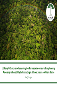
ecrs_2_CarlyVoightPresentation.pdf
An Automated Model to Classify Barrier Island Geomorphology using Lidar Data
Vertical Segmentation of Airborne LiDAR for Select Australian Vegetation Communities