Event submissions
Published

This submission belongs to the session C. Earth Sciences through Earth Observation of the event 2nd International Electronic Conference on Geosciences
Published date
05 Jun, 2019
Citation
Abbas Ebrahimi, Mohammad Reza Bayanlou, Mehdi Khoshboresh Masouleh, SAMA-VTOL Aerial Image Dataset (SVAID): A New UAV Image Dataset for Advanced Remote Sensing Research, in Proceedings of 2nd International Electronic Conference on Geosciences, 8 June–15 June 2019, MDPI: Basel, Switzerland, doi: 10.3390/IECG2019-06204
Share
Email
Facebook
Twitter
LinkedIn
SAMA-VTOL Aerial Image Dataset (SVAID): A New UAV Image Dataset for Advanced Remote Sensing Research
'%3e%3cpath%20d='M12.6647%2010.9104C12.4176%2010.325%2012.0589%209.7933%2011.6088%209.34485C11.16%208.89511%2010.6283%208.53653%2010.0432%208.28891C10.038%208.28629%2010.0327%208.28498%2010.0275%208.28236C10.8437%207.69282%2011.3743%206.73252%2011.3743%205.64907C11.3743%203.85423%209.92005%202.40002%208.12522%202.40002C6.33038%202.40002%204.87618%203.85423%204.87618%205.64907C4.87618%206.73252%205.40677%207.69282%206.22296%208.28367C6.21772%208.28629%206.21248%208.2876%206.20724%208.29022C5.62031%208.53783%205.09365%208.89287%204.64167%209.34616C4.19192%209.79496%203.83334%2010.3266%203.58573%2010.9117C3.34247%2011.4846%203.21128%2012.0987%203.19925%2012.721C3.1989%2012.735%203.20135%2012.7489%203.20646%2012.7619C3.21157%2012.7749%203.21924%2012.7868%203.22901%2012.7968C3.23877%2012.8068%203.25045%2012.8148%203.26334%2012.8202C3.27623%2012.8256%203.29007%2012.8284%203.30406%2012.8284H4.09012C4.14776%2012.8284%204.19362%2012.7825%204.19493%2012.7262C4.22113%2011.7148%204.62726%2010.7676%205.34519%2010.0497C6.08802%209.30686%207.07452%208.89811%208.12522%208.89811C9.17592%208.89811%2010.1624%209.30686%2010.9052%2010.0497C11.6232%2010.7676%2012.0293%2011.7148%2012.0555%2012.7262C12.0568%2012.7839%2012.1027%2012.8284%2012.1603%2012.8284H12.9464C12.9604%2012.8284%2012.9742%2012.8256%2012.9871%2012.8202C13%2012.8148%2013.0117%2012.8068%2013.0214%2012.7968C13.0312%2012.7868%2013.0389%2012.7749%2013.044%2012.7619C13.0491%2012.7489%2013.0515%2012.735%2013.0512%2012.721C13.0381%2012.0947%2012.9084%2011.4856%2012.6647%2010.9104ZM8.12522%207.90243C7.52388%207.90243%206.95792%207.66793%206.53214%207.24215C6.10636%206.81636%205.87185%206.2504%205.87185%205.64907C5.87185%205.04773%206.10636%204.48177%206.53214%204.05599C6.95792%203.63021%207.52388%203.3957%208.12522%203.3957C8.72655%203.3957%209.29252%203.63021%209.7183%204.05599C10.1441%204.48177%2010.3786%205.04773%2010.3786%205.64907C10.3786%206.2504%2010.1441%206.81636%209.7183%207.24215C9.29252%207.66793%208.72655%207.90243%208.12522%207.90243Z'%20fill='%235D1EE1'/%3e%3c/g%3e%3c/svg%3e)
Abbas Ebrahimi 1
Mohammad Reza Bayanlou 1
Mehdi Khoshboresh Masouleh 2
1. Aerospace Engineering Department, Sharif University of Technology, Tehran, Iran
2. School of Surveying and Geospatial Engineering, College of Engineering, University of Tehran,
Tehran, Iran
Abstract
SAMA-VTOL aerial image dataset (SVAID) is a new open unmanned aerial vehicles (UAV) image dataset for a wide range of scientific projects in remote sensing (i.e. 3D object modeling, rural/urban mapping, digital elevation/surface model processing, etc.). Open high-quality UAV images play an important part in providing and expanding spatial data processing methods. The SVAID includes 120 rural/urban scene images with 80% overlap between images (forward overlap) and 60% overlap between flight lines (side overlap) from part of Esfahan province, Iran. The characteristics that make the SVAID an excellent scientific dataset are: (i) very high ground sampling distance (GSD) due to suitable fly height selection; (ii) GNSS-PPK (Post Processing Kinematic) system for improving the spatial accuracy without ground control points (GCPs); (iii) various landscape types (i.e. different types of roofs for commercial/residential buildings, vegetation, etc.), and (iv) uses of the new UAV-photogrammetry platform, named SAMA-VTOL (2019) has been developed by TAREQH Corporation. Additionally, The Agisoft Metashape software was used to analyzing images and produce point clouds, digital surface model (DSM) and orthoimage for evaluating SVAID quality and quantity.
Keywords
SVAID
remote sensing
UAV
SAMA-VTOL
TAREQH
Manuscript
Manuscript.SVAID.IECG2019.pdf
Poster
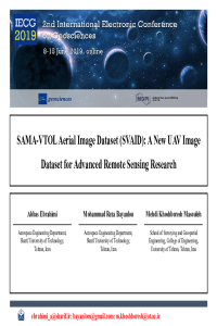
Presentation.SVAID.IECG2019.pdf
Top down instead of bottom up chronostratigraphic definitions
Phenological Monitoring of Paddy crop using Time Series MODIS Data