Event submissions
Published

This submission belongs to the session A. Managing Water Resources from Aquifers, Rivers and Lakes of the event The 4th International Electronic Conference on Water Sciences
Published date
12 Nov, 2019
Citation
Calogero Benedetto Rizzo, Felipe P. J. de Barros, A tool to estimate the location of high conductivity channels in heterogeneous porous media, in Proceedings of The 4th International Electronic Conference on Water Sciences, 13 November–29 November 2019, MDPI: Basel, Switzerland, doi: 10.3390/ECWS-4-06425
Share
Email
Facebook
Twitter
LinkedIn
A tool to estimate the location of high conductivity channels in heterogeneous porous media
'%3e%3cpath%20d='M12.6647%2010.9104C12.4176%2010.325%2012.0589%209.7933%2011.6088%209.34485C11.16%208.89511%2010.6283%208.53653%2010.0432%208.28891C10.038%208.28629%2010.0327%208.28498%2010.0275%208.28236C10.8437%207.69282%2011.3743%206.73252%2011.3743%205.64907C11.3743%203.85423%209.92005%202.40002%208.12522%202.40002C6.33038%202.40002%204.87618%203.85423%204.87618%205.64907C4.87618%206.73252%205.40677%207.69282%206.22296%208.28367C6.21772%208.28629%206.21248%208.2876%206.20724%208.29022C5.62031%208.53783%205.09365%208.89287%204.64167%209.34616C4.19192%209.79496%203.83334%2010.3266%203.58573%2010.9117C3.34247%2011.4846%203.21128%2012.0987%203.19925%2012.721C3.1989%2012.735%203.20135%2012.7489%203.20646%2012.7619C3.21157%2012.7749%203.21924%2012.7868%203.22901%2012.7968C3.23877%2012.8068%203.25045%2012.8148%203.26334%2012.8202C3.27623%2012.8256%203.29007%2012.8284%203.30406%2012.8284H4.09012C4.14776%2012.8284%204.19362%2012.7825%204.19493%2012.7262C4.22113%2011.7148%204.62726%2010.7676%205.34519%2010.0497C6.08802%209.30686%207.07452%208.89811%208.12522%208.89811C9.17592%208.89811%2010.1624%209.30686%2010.9052%2010.0497C11.6232%2010.7676%2012.0293%2011.7148%2012.0555%2012.7262C12.0568%2012.7839%2012.1027%2012.8284%2012.1603%2012.8284H12.9464C12.9604%2012.8284%2012.9742%2012.8256%2012.9871%2012.8202C13%2012.8148%2013.0117%2012.8068%2013.0214%2012.7968C13.0312%2012.7868%2013.0389%2012.7749%2013.044%2012.7619C13.0491%2012.7489%2013.0515%2012.735%2013.0512%2012.721C13.0381%2012.0947%2012.9084%2011.4856%2012.6647%2010.9104ZM8.12522%207.90243C7.52388%207.90243%206.95792%207.66793%206.53214%207.24215C6.10636%206.81636%205.87185%206.2504%205.87185%205.64907C5.87185%205.04773%206.10636%204.48177%206.53214%204.05599C6.95792%203.63021%207.52388%203.3957%208.12522%203.3957C8.72655%203.3957%209.29252%203.63021%209.7183%204.05599C10.1441%204.48177%2010.3786%205.04773%2010.3786%205.64907C10.3786%206.2504%2010.1441%206.81636%209.7183%207.24215C9.29252%207.66793%208.72655%207.90243%208.12522%207.90243Z'%20fill='%235D1EE1'/%3e%3c/g%3e%3c/svg%3e)
Calogero Benedetto Rizzo 1
Felipe P. J. de Barros 1
1. University of Southern California
Abstract
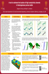
Solute transport in groundwater is characterized by a high level of uncertainty since it is impossible to completely measure the spatial distribution of key soil properties, such as the hydraulic conductivity. Several studies have shown how an heterogeneous hydraulic conductivity field may lead to the formation of preferential channels (or high conductivity channels) in which the solute flows. Given a realization of the hydraulic conductivity field, it is possible to estimate the location of preferential channels using a graph-theory based method. The minimum hydraulic resistance and least resistance path are efficiently computed, so that these metrics can be effectively employed to assess the uncertainty of preferential flows using computationally intensive stochastic methods, such as Monte-Carlo simulations. For example, these metrics can be used for site characterization, choosing locations where to sample the hydraulic conductivity in order to reduce the uncertainty of high conductivity channels. As a consequence, our preliminary studies displayed more than 40% reduction on first arrival time uncertainty, when compared to a regular grid sampling protocol with the same number of sampling locations. The iterative sampling strategy can be reproduced using LazyMole, an open-source tool implementing the algorithms to compute the minimum hydraulic resistance and least resistance path for a given hydraulic conductivity field.
Keywords
groundwater flow and transport
connectivity
preferential flow
geostatistics
Poster
ecws-rizzo-t.pdf
Evaluation of RapidEye-3 Satellite Data for Assessing Water Turbidity of Lake Borabey
Shear-thinning fluid flow in variable aperture channels