Event submissions
Published

This submission belongs to the session G. Poster of the event The 5th International Electronic Conference on Water Sciences
Published date
13 Nov, 2020
Citation
Talal Naseer, Stefano Vignudelli, Arjumand Zaidi, Study of Sea Surface Temperature (SST) and Sea Level Rise (SLR) Along Karachi Coast using Satellite Data, Pakistan, in Proceedings of The 5th International Electronic Conference on Water Sciences, 16 November–30 November 2020, MDPI: Basel, Switzerland, doi: 10.3390/ECWS-5-08039
Share
Email
Facebook
Twitter
LinkedIn
Study of Sea Surface Temperature (SST) and Sea Level Rise (SLR) Along Karachi Coast using Satellite Data, Pakistan

Talal Naseer 1

Stefano Vignudelli 2
'%3e%3cpath%20d='M12.6647%2010.9104C12.4176%2010.325%2012.0589%209.7933%2011.6088%209.34485C11.16%208.89511%2010.6283%208.53653%2010.0432%208.28891C10.038%208.28629%2010.0327%208.28498%2010.0275%208.28236C10.8437%207.69282%2011.3743%206.73252%2011.3743%205.64907C11.3743%203.85423%209.92005%202.40002%208.12522%202.40002C6.33038%202.40002%204.87618%203.85423%204.87618%205.64907C4.87618%206.73252%205.40677%207.69282%206.22296%208.28367C6.21772%208.28629%206.21248%208.2876%206.20724%208.29022C5.62031%208.53783%205.09365%208.89287%204.64167%209.34616C4.19192%209.79496%203.83334%2010.3266%203.58573%2010.9117C3.34247%2011.4846%203.21128%2012.0987%203.19925%2012.721C3.1989%2012.735%203.20135%2012.7489%203.20646%2012.7619C3.21157%2012.7749%203.21924%2012.7868%203.22901%2012.7968C3.23877%2012.8068%203.25045%2012.8148%203.26334%2012.8202C3.27623%2012.8256%203.29007%2012.8284%203.30406%2012.8284H4.09012C4.14776%2012.8284%204.19362%2012.7825%204.19493%2012.7262C4.22113%2011.7148%204.62726%2010.7676%205.34519%2010.0497C6.08802%209.30686%207.07452%208.89811%208.12522%208.89811C9.17592%208.89811%2010.1624%209.30686%2010.9052%2010.0497C11.6232%2010.7676%2012.0293%2011.7148%2012.0555%2012.7262C12.0568%2012.7839%2012.1027%2012.8284%2012.1603%2012.8284H12.9464C12.9604%2012.8284%2012.9742%2012.8256%2012.9871%2012.8202C13%2012.8148%2013.0117%2012.8068%2013.0214%2012.7968C13.0312%2012.7868%2013.0389%2012.7749%2013.044%2012.7619C13.0491%2012.7489%2013.0515%2012.735%2013.0512%2012.721C13.0381%2012.0947%2012.9084%2011.4856%2012.6647%2010.9104ZM8.12522%207.90243C7.52388%207.90243%206.95792%207.66793%206.53214%207.24215C6.10636%206.81636%205.87185%206.2504%205.87185%205.64907C5.87185%205.04773%206.10636%204.48177%206.53214%204.05599C6.95792%203.63021%207.52388%203.3957%208.12522%203.3957C8.72655%203.3957%209.29252%203.63021%209.7183%204.05599C10.1441%204.48177%2010.3786%205.04773%2010.3786%205.64907C10.3786%206.2504%2010.1441%206.81636%209.7183%207.24215C9.29252%207.66793%208.72655%207.90243%208.12522%207.90243Z'%20fill='%235D1EE1'/%3e%3c/g%3e%3c/svg%3e)
Arjumand Zaidi 1
1. United States - Pakistan Center for Advanced Studies in Water, Mehran University of Engineering and Technology, Jamshoro, Pakistan
2. Italian National Research Council | CNR
Abstract
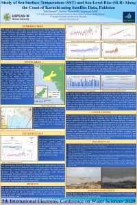
The rising temperature due to climate change leads to glaciers melting, causing increased sea levels and sea surface temperatures (SST). The rising SST and glacier melting elevate sea levels around the globe. The rising sea level is hazardous for the coastal regions worldwide, and therefore, calls for continuous monitoring to manage this threat. Pakistan, with a coastline of 990 km long, is among those countries most vulnerable to sea-level rise (SLR). Around 10% of Pakistan's population lives near the coastal zones, which are most marginalized and dependent on fishing and small agricultural farms. An SLR of a few millimeters per year is a serious threat to Pakistan's coastal areas that can, directly and indirectly, cause land loss of low-lying areas and destruction of infrastructures, human settlements, agriculture lands, and coastal ecosystems and other resources. The coastal communities of developing countries such as Pakistan, lacking essential resources, are the most disadvantageous and adversely affected people of the world due to these disasters. To overcome resources and capacity constraints, remote sensing (RS) and GIS techniques can employ to monitor coastal zones at larger extents. In this study, SLR and SST around the coast of Karachi have been investigated using multi-mission satellite radar altimetry (SRA) and MODIS Terra L3 SST product. The SRA is used to monitor sea levels using data from 1993 to 2018. Similarly, monthly SST data from 2000 to 2019 have been acquired to monitor SST trends. The rises in sea levels and temperatures were estimated as 3.9 mm/year and 0.0138 °C/year respectively. Different extrapolation techniques can further be utilized to predict the potential of SLR and SST in the study area for developing future coastal zone management plans.
Keywords
Sea surface temperature
Sea level rise
Remote sensing
GIS techniques
Satellite radar altimetry
Coastal zone management plans
Manuscript
sciforum-038836.pdf
Poster
ECWS-5_SLR and SST (Final Draft).pdf
Thermal treated zeolite as catalyst in heterogeneous catalytic ozonation – optimization of experimental conditions and micropollutants degradation
A comparative assessment of the riparian vegetation status using two different indices: Results from a large-scale study in Greece.