

Topics Webinar | Drones for Rural Development I
the chairs
The utilization of drones is experiencing global growth, with the continual emergence of fresh applications and uses. In remote, rural regions, drones have the potential to perform a wide range of tasks, including surveillance via cameras or other sensors, acting as mobile gateways to provide connectivity, or facilitating the transportation of goods to challenging, remote locations. While many of these applications are closely associated with primary sector activities like agriculture and livestock, their adaptability extends to various other industries and urban areas.
This Webinar will present three referent European projects for developing rural areas using drones as the main thread. The scope of drone utilization in rural regions is extensive, spanning across sectors like agriculture, forestry, livestock, other industrial domains, environmental monitoring, and the assessment of water quality in rivers and lakes. Drones also play a vital role in firefighting efforts and providing assistance to the population, particularly elderly individuals.
We are privileged to have recognized industry and academic experts who will share their experiences and insights on how to effectively leverage these technologies to achieve better results and improve drone productivity in different applications. So, whether you are a researcher, applied scientist, commercial drone user, or simply interested in the latest trends in drones, we invite you to join us for this webinar.
Date: 09 October 2023 at 2:00 p.m. CEST | 8:00 a.m. EDT | 8:00 p.m. CST Asia
Webinar ID: 879 5977 6644
Webinar Secretariat: journal.webinar@mdpi.com
Meet Our Chairs

Cartographic and Land Engineering Department, Higher Polytechnic School of Avila, University of Salamanca, Salamanca, Spain;Received a B.Sc. degree in Surveying Engineering and a M.Sc. degree in Geodesy and Cartography Engineering from Salamanca University, Spain, in 1999 and 2001, respectively. He was a Research Assistant at INRIA, Grenoble, France, in the Institute of Computer Vision and Robotics, where he also carried out his Ph.D. research on 3D reconstruction from a single view, graduating in 2005. He has authored over 370 research articles in international journals and conference proceedings, and is the co-inventor of 11 patents and 32 intellectual properties (software). Based on his PhD results, he has received nine international awards from the International Societies of Photogrammetry and Remote Sensing (ISPRS/ASPRS). In 2005, he founded the research group TIDOP (https://tidop.usal.es) (Geotechnologies for the 3D digitization and modelling of complex objects) at the University of Salamanca. He is Full Professor and Head of the Geotechnologies Master and PhD Program at the University of Salamanca, co-founder and CEO of the start-up ITOS3D (Image TO Smart 3D). In 2015, the Royal Academy of Engineering recognised his efforts and work in the field of engineering, in particular in the democratization of photogrammetry. In 2020, the ISPRS recognized his special, personal and meritorious contributions in the field of photogrammetry, being only the second Spanish person to recieve this award since its origin in 1996.

Department of Mining Technology, Topography and Structures, University of León, Ponferrada, Spain;Dr. Pablo Rodríguez Gonzálvez, surveyor (2004), geodesist and cartographer (2006) and PhD in photogrammetry (2011), worked at the university of Salamanca for 8 years before joining the university of León in 2017. He is currently Associate Professor at the Department of Mining Technology, Topography and Structures, and coordinator of the DRACONES research group. He has authored over 120 research articles in international journals and conference proceedings, all related to the transversal application of different Geomatics techniques. He has been the main researcher of eight technological contracts, the majority of which were associated with the University–Business Knowledge Transfer and related to the application of Geomatics to different disciplines. He holds 10 national patents and 20 intellectual properties. His main research lines include photogrammetry 3D reconstruction, accuracy assessment, and radiometric and geometric calibration of different geomatic sensors. Finally, he is member of the National management committee of COST Action CA16219 “Harmonization of UAS techniques for agricultural and natural ecosystems monitoring”, and co-editor-in-chief of the journal Drones.
Meet Our Speakers

Institute for Bio-Economy and Agri-Technology (iBO), Centre for Research & Technology Hellas (CERTH), Volos, Greece;Dr. Aristotelis Tagarakis is a Researcher at the Institute for Bio-economy and Agri-technology (iBO/CERTH) with expertise in precision agriculture. Dr Tagarakis received an MSc degree in “Automation in Irrigation, Farm Structures and Farm Mechanization” and a PhD degree in “Precision Agriculture” from the University of Thessaly, Greece. He worked as a research scholar at the Biosystems Engineering department of Auburn University, AL, U.S.A., in the area of Precision Agriculture, variable rate fertilization and automated irrigation in maize. Additionally, he has been Postdoctoral Associate at Cornell University, N.Y., U.S.A., leading the precision agriculture program. Before joining the iBO he was a senior researcher at the BioSense Institute in Serbia. He has significant research experience working at numerous national, European, and other international projects. His main research interests include precision agriculture, digital farming, agricultural automation, agri-robotics, remote/proximal sensing, the Internet of Things (IoT) and sensor networks in agriculture.
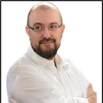
Acceligence Hellas Ltd, Athens, Greece;Dr. Pantelis Velanas is the CEO of ACCELIGENCE Ltd. Dr. Velanas received a B.S. degree in physics, an M.Sc. degree in telecommunications and a Ph.D. in photonics from the National and Kapodistrian University of Athens, in 2000, 2002 and 2009, respectively, and he has worked at the same university as a researcher in the Optical Communication Laboratory, participating in several FP6 and FP7 EUprojects (OCCULT, WAPITI, E-photon 1, BONE). From 2007, he has worked as an R&D project manager in numerous companies (e.g., Intracom Telecom SA – SARDANA, ACCORDANCE, KONNEKTABLE LTD – SPHINX, ENERGYSHIELD, PALAEMON, NAIADES, TRACK & KNOW) and research institutes (e.g., ICCS – INTETRANSIT, PPDR, RECONASS, ZONESEC, CERTH – FORTIKA, SMILE, NOTREMOR, COMPOSITION) in Greece. Currently, Dr. Pantelis Velanas focuses on the management of R&D projects and development of solutions for sustainable digital rural development and digital surveillance through the use of aerial enablers and cutting edge applications of AI technologies.
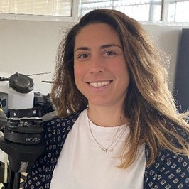
Department of Natural Resources Management and Agricultural Engineering, Agricultural University of Athens, Athens, Greece;Dr. Aikaterini Kasimati is an experienced agricultural engineer specialising in precision agriculture, bioenvironmental engineering and energy production. Holding an M.S. degree in Agricultural and Biological Engineering from the University of Illinois at Urbana-Champaign and a Ph.D. in Precision Agriculture and Big Data Analytics, she currently serves as a dynamic Postdoctoral Research Associate. Her role involves managing EC-funded projects and leading proposal writing. With a rich academic journey spanning multiple countries, Dr. Aikaterini has refined her skills in effective communication, interpersonal relations, time management, and organisation.

ACCELIGENCE LTD, Nicosia, Cyprus;Mr. Dimitris Pericleous works as an aeronautical engineer at ACCELIGENCE Ltd. He graduated from the University of Patras with an Integrated Master of Mechanical Engineering and Aeronautics with a specialization in Aeronautics in August 2021. He has been a member of the ACCELIGNECE UAV Team since January 2022. Demetris possesses extensive knowledge and experience in the conceptual, preliminary, and detailed design of Unmanned Aerial Vehicles (UAVs) and in mainly focused and engaged with CFD and EFD analysis, CAD design and aerodynamic optimization.






On Monday, 09 October 2023, MDPI and the journals Drones, Remote Sensing, IJGI, Land and Geomatics organized a Topics webinar entitled "EO&GEO Series: Drones for Rural Development".
The webinar explored the innovative use of drones and data analysis in the primary sector (agriculture, forestry, and livestock), with a strong emphasis on enhancing environmental monitoring, sustainability, and rural development. The recognized speakers discussed versatile drone ecosystems, reconfigurable platforms, and innovative applications, collectively highlighting the transformative potential of these technologies in addressing pressing challenges within these sectors while providing assistance to the end-users.
This webinar was hosted via Zoom and required registration to attend. The full recording can be found below. In order to learn about future webinars, you can sign up to our newsletter by clicking “Subscribe” at the top of the page
"Advances in Earth Observation and Geosciences"
Topic Editors: Prof. Dr. Diego González-Aguilera and Dr. Pablo Rodríguez Gonzálvez
Abstract Submission Deadline: 31 December 2023
"Advances of UAV in Precision Agriculture"
Guest Editors: Dr. Görres Grenzdörffer and Dr. Jian Chen
Deadline for Manuscript Submissions: 14 January 2024
"UAS Technology and Applications in Precision Agriculture"
Guest Editors: Dr. Jinha Jung, Dr. Murilo M. Maeda and Dr. Mahendra Bhandari
Deadline for Manuscript Submissions: 30 November 2023
"Comparison of Image Endmember- and Object-Based Classification of Very-High-Spatial-Resolution Unmanned Aircraft System (UAS) Narrow-Band Images for Mapping Riparian Forests and Other Land Cover"
Land 2022, 11(2), 246; https://doi.org/10.3390/land11020246
"Coastal Wetland Vegetation Classification Using Pixel-Based, Object-Based and Deep Learning Methods Based on RGB-UAV"
Land 2022, 11(11), 2039; https://doi.org/10.3390/land11112039
"Performance Evaluation of Parallel Structure from Motion (SfM) Processing with Public Cloud Computing and an On-Premise Cluster System for UAS Images in Agriculture"
ISPRS Int. J. Geo-Inf. 2021, 10(10), 677; https://doi.org/10.3390/ijgi10100677
"Fine Crop Classification Based on UAV Hyperspectral Images and Random Forest"
ISPRS Int. J. Geo-Inf. 2022, 11(4), 252; https://doi.org/10.3390/ijgi11040252