
Topics Webinar | EO&GEO Series: GIS Day
the chair
It is a great pleasure to welcome you to the special webinar to commemorate Geographic Information Systems (GIS) Day (https://www.gisday.com/en-us/overview). This webinar is organised by the MDPI open access journal to encourage scientists to raise awareness about the importance of geography and GIS technology.
GIS Day is a chance to celebrate and enjoy all the exciting GIS activities and projects conducted and accomplished over the year. GIS Day provides an international forum for learners, scholars, and practitioners of geographic information science and technology to demonstrate real-world applications that make a difference in our society.
The first formal GIS Day took place in 1999. Esri president and co-founder Jack Dangermond credits Ralph Nader as the person who inspired the creation of GIS Day. Nader considered GIS Day a good initiative for people to learn about geography and the uses of GIS and wanted GIS Day to be a grassroots effort open to everyone.
We look forward to seeing you at the Topics Webinar | EO&GEO Series: GIS Day. Please find an up-to-date outline of the presenters below.
Date: 15 November 2023 at 3:00 a.m. CET | 10:00 p.m. EDT | 10:00 a.m. CST Asia
Webinar ID: 852 8660 1567
Webinar Secretariat: journal.webinar@mdpi.com
Meet Our Chair
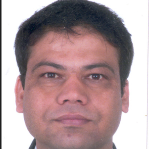
School of Surveying and Built Environment, University of Southern Queensland, Queensland, Australia;Dr. Dev Raj Paudyal has worked as a University Lecturer at the School of Surveying and Built Environment, University of Southern Queensland (UniSQ), Australia, since 2011. Dr Paudyal holds an M.Sc. in Geoinformation Management (with a specialisation in Land Administration) from ITC, the Netherlands, and a Ph.D. from the University of Southern Queensland (UniSQ), Australia. He worked as a Research Scholar at the Graduate School of Design, Harvard University (2015–2016). Dr Paudyal served as the President of the International Geospatial Society (2013–2015) and Co-Chair of the International Society for Photogrammetry and Remote Sensing (ISPRS)-WGIV/4: (Geospatial Data Infrastructure, 2012–2016). He has been working as Co-Chair of ISPRS-WGIV/4 (SDI: Internet of Things and Spatial Decision Support) and was a Board Director of the Global Spatial Data Infrastructure (GSDI) Association and a delegate of the GSDI Association Council. In addition to this, Dr Paudyal is a member of the International Society for Photogrammetry and Remote Sensing (ISPRS), a member of the International Global Navigation Satellite Systems (GNSS) group, a member of the Mixed Methods International Research Association (MMIRA), and a life member of the Nepal Photogrammetry and Remote Sensing Society. He is Associate Editor of ISPRS International Journal of Geo-Information (IJGI). Dr Paudyal has more than 25 years of professional and research experience, including 10 years of full-time industry experience in Nepal's Survey Department (National Mapping Agency) and 15 years of teaching and research experience in Australia, India, and Nepal. He has supervised twenty-five successful postgraduate and honours students and is currently supervising eight PhD students and five honours students. Dr Paudyal has also been consulted on SDI, application of geospatial information in disaster risk management, land administration, and spatial data management by the Ministry of Land Reform and Management, Kathmandu University, Tribhuwan University, Institute of Engineering, and the World Bank.
Meet Our Speakers
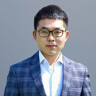
School of Design and the Built Environment, Curtin University, Perth, Australia;Dr. Yongze Song is a Senior Lecturer at Curtin University. He is a RGS Fellow (UK), DAAD AInet Fellow (Germany), and a Committee Member of the International Association for Mathematical Geosciences (IAMG). Yongze leads a Geospatial Analysis and AI team, maintaining strong industry networks and delivering industry-driven research projects about sustainable infrastructure management using emerging technologies. He developed more than 16 new geospatial methods and eight R software packages with over 120,000 downloads for understanding geographical and spatial data. He is an Associate Editor for the International Journal of Applied Earth Observation and Geoinformation, GIScience & Remote Sensing, and All Earth, and an Editor for the Geoscientific Model Development and Journal of Spatial Science. He is a recipient of more than ten awards at international and national levels, such as the Geospatial World 50 Rising Stars, the Global Top 10 Young Scientist Award, the World’s Top 2% Scientists by Stanford University, and the Australian National Location Data First Prize.
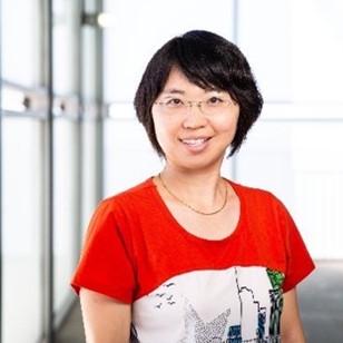
School of Geographical Sciences and Urban Planning, Arizona State University, Tempe, Arizona, United States;Dr. Wenwen Li is a Professor at the School of Geographical Sciences and Urban Planning at Arizona State University. Her research interest is geographic information science, focusing on developing integrated and smart cyberinfrastructure to revolutionize knowledge discovery in environmental and social sciences. In recent years, she has been pioneering the integration of AI with geospatial sciences and has developed a series of spatial explicit GeoAI models for environmental analysis. Dr. Li’s research was funded by multiple funding agencies. She received the US National Science Foundation’s early CAREER and Mid-Career Advancement awards. She is also a Fellow of the American Association of Geography (AAG) and the University Consortium of Geographic Information Science.

Center for Geospatial Research (CGR), Department of Geography, University of Georgia, Athens, Georgia, USA;Prof. Dr. Marguerite Madden is a Professor in the Department of Geography at the University of Georgia (UGA) and Director of the Center for Geospatial Research (CGR). She holds Bachelor and Master of Arts degrees in Biology from the State University of New York and a Ph.D. in Ecology from the University of Georgia. Since the late 1970s, she has conducted research combining geospatial data and analyses with landscape ecology, particularly focused on human–animal–environment interactions. Joining the UGA-CGR in 1985, she developed and analyzed numerous multi-temporal and detailed vegetation databases for local and regional conservation lands. Professor Madden is an American Society of Photogrammetry and Remote Sensing (ASPRS) Past President (2007) and Editor of the 2009 ASPRS Manual of GIS. She served as the International Society for Photogrammetry and Remote Sensing (ISPRS) Commission IV, “Digital Mapping and Geodatabases” Technical President (2008–2012), ISPRS Council Second Vice President (2012-2016) and Treasurer of The ISPRS Foundation (2010–2022). She is a Fellow of ASPRS (2010) and ISPRS (2020), and a recipient of a NASA Silver Achievement Medal (2018), ASPRS Life-Time Achievement Award (2020) and AAG Remote Sensing Specialty Group Outstanding Contributions to Remote Sensing Award (2021). Since 2020, she has served on the U.S. National Academies of Sciences, Engineering and Medicine’s Geographical and Geospatial Sciences Committee.



On Wednesday, 15 November 2023, MDPI, ISPRS International Journal of Geo-Information and Remote Sensing, organized the webinar titled “Topics Webinar | EO&GEO Series: GIS Day".
This year, the GIS day was celebrated organizing a special webinar by this MDPI open access journal to raise awareness about the importance of geospatial science and technology and its application. The webinar was very successful. We had three distinguished scholars from Australia and the USA who delivered the presentation.
The first speaker was Dr Yongze Song from Curtin University who delivered a presentation on the topic titled " The Second Dimension Spatial Association: Concepts and Application". He discussed novel approaches to improve the prediction accuracy and explained the outputs comparing it with current machine learning models (such as random forest). He also showed the application of R packages, e.g., SecDim. The second speaker was Professor Wenwen Li, and her presentation topic was on " The power of GeoAI in Earth and Environmental Science". She illustrated the application of GeoAI for rescue operation, Arctic permafrost research, and flood mapping. She also discussed about the power of GeoAI and the challenges in undertaking multi-source and multi-model challenges. She further discussed about the emerging research question " how can we trust results from GeoAI". The last speaker was Professor Dr Marguerite Madden, and her webinar topic was titled " Mitigating Human - Elephant Conflict in Southern Africa using Geo Spatial Analysis of Bull Elephant Movement". She entertained participants by discussing about the outputs of one of research project which was undertaken in Kruger National Park, South Africa, in the mid 1990s when the application of GPS technology was just started. She highlighted the outputs of a current research project which is running in African countries. The key message from her presentation was that although we have developed many technologies and technical solutions, we still need human engagement and community participation for the success of any research project.
At the end of the presentation, there was a Q/A session that was very interesting. The panel members answered the questions raised by participants. The webinar was closed by the chair Dr Dev Raj Paudyal, who highlighted the key outputs. This webinar program was facilitated by You Wu from MDPI.
The webinar was hosted via Zoom and required registration to attend. The full recording can be found below. In order to learn about future webinars, you can sign up to our newsletter by clicking “Subscribe” at the top of the page.
ISPRS International Journal of Geo-Information (IJGI)
"Harnessing the Geospatial Data Revolution for Promoting Sustainable Transport Systems"
Special Issue Editors: Dr. Xiao Li, Dr. Xiao Huang and Dr. Zhenlong Li
Deadline for Manuscript Submissions: 30 November 2023
"Trustful and Ethical Use of Geospatial Data"
Special Issue Editors: Prof. Dr. Maria Antonia Brovelli, Prof. Dr. Songnian Li andDr. Ivana Ivánová
Deadline for Manuscript Submissions: 31 December 2023
Remote Sensing
"New Trends of GEOBIA in Remote Sensing"
Special Issue Editors: Prof. Dr. Elif Sertel and Prof. Dr. Jagannath Aryal
Deadline for Manuscript Submissions: 30 April 2024
"Remote Sensing, GIS, and Artificial Intelligence for Monitoring Environmental Changes"
Special Issue Editors: Prof. Dr. Duk-Jin Kim and Dr. Junwoo Kim
Deadline for Manuscript Submissions: 19 January 2024
ISPRS International Journal of Geo-Information (IJGI)
"Group-Privacy Threats for Geodata in the Humanitarian Context"
ISPRS Int. J. Geo-Inf. 2023, 12(10), 393; https://doi.org/10.3390/ijgi12100393
"An Ontology-Based Framework for Geospatial Integration and Querying of Raster Data Cube Using Virtual Knowledge Graphs"
ISPRS Int. J. Geo-Inf. 2023, 12(9), 375; https://doi.org/10.3390/ijgi12090375
"Modelling Global Deforestation Using Spherical Geographic Automata Approach"
ISPRS Int. J. Geo-Inf. 2023, 12(8), 306; https://doi.org/10.3390/ijgi12080306
"Interactive Thematic Map as a Means of Documenting and Visualizing Information about Cultural Heritage Objects"
ISPRS Int. J. Geo-Inf. 2023, 12(7), 257; https://doi.org/10.3390/ijgi12070257
Remote Sensing
"Knowledge-Driven GeoAI: Integrating Spatial Knowledge into Multi-Scale Deep Learning for Mars Crater Detection"
Remote Sens. 2021, 13(11), 2116; https://doi.org/10.3390/rs13112116
"Earth Observation for Sustainable Infrastructure: A Review"
Remote Sens. 2021, 13(8), 1528; https://doi.org/10.3390/rs13081528
"Enhancing the Accuracy and Temporal Transferability of Irrigated Cropping Field Classification Using Optical Remote Sensing Imagery"
Remote Sens. 2022, 14(4), 997; https://doi.org/10.3390/rs14040997
"Spatio-Temporal Mixed Pixel Analysis of Savanna Ecosystems: A Review"
Remote Sens. 2021, 13(19), 3870; https://doi.org/10.3390/rs13193870