
Topics Webinar | EO&GEO Series: GIS in the Management of Sustainable and Smart Cities
Meet Our Speaker
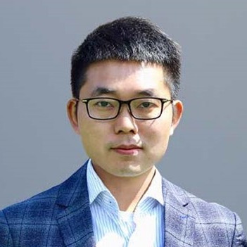
School of Design and the Built Environment, Curtin University, Bentley, WA, Australia;Dr Yongze Song leads a Geospatial Analysis and AI team and developed more than 15 new geospatial models and 8 open-source software with over 100,000 downloads globally for understanding geographical and spatial data. The developed new models and software demonstrate both academic and industrial impacts globally. He is a recipient of more than ten awards at international and national levels, such as the Global Top 10 Young Scientist Award and the Australian National Location Data First Prize. He is a Fellow of the Royal Geographical Society (RGS), UK, and a Committee Member of the International Association for Mathematical Geosciences (IAMG). He is an Editorial Board Member of 7 reputable international peer-reviewed journals, including GIScience & Remote Sensing, iScience (Cell Press), Annals of GIS, Remote Sensing, Geo-spatial Information Science, etc. He serves as a Chair or Program Committee Member for international conferences held in over 10 countries, including Australia, the United Kingdom, Egypt, Norway, China, France, the United States, Canada, Iran, Vanuatu, and Greece. He was invited to present more than 40 research seminars at universities (e.g., Harvard University, Australian National University, National University of Singapore, Peking University, etc.) and industries globally. Find out more at: https://yongzesong.com/about/.





On Thursday, 9 March 2023, MDPI and the Journal Remote Sensing organized the 8th Topics webinar, entitled "EO&GEO Series: GIS in the Management of Sustainable and Smart Cities".
The introduction was held by the Chair of the webinar, Dr. Yongze Song from the Curtin University in Bentley, WA, Australia. He leads a Geospatial Analysis and AI team and developed more than 15 new geospatial models and 8 open-source software with over 100,000 downloads globally for understanding geographical and spatial data. The developed new models and software demonstrate both academic and industrial impacts globally.
The first speaker to kick off this webinar was Dr. Cheolhee Yoo, a Research Assistant Professor at The Hong Kong Polytechnic University. His research interests include urban remote sensing, geographic information system, and the use of artificial intelligence to interpret remote sensing images for disaster management and environmental monitoring. Dr. Yoo's presentation was entitled "Urban Climate Studies: Remote Sensing Meets Artificial Intelligence (AI) Technology".
The second presentation with the title "Towards Smart Cities: Vision, Challenges, Solution and Case Studies" was held by Dr. Linlin You. His research interests include smart cities, autonomous transportation systems, multi-source data fusion, machine learning, and federated learning. He is an Associate Professor at the School of Intelligent Systems Engineering at the Sun Yat-Sen University in Guangdong, China, and also a research affiliate at the Intelligent Transportation System Lab at the MIT in Cambridge, MA in the United States.
Dr. Bing Liu from the Technical University of Munich in Germany and the BYD Group in China was the third speaker and her presentation was entitled "Spatial Perception and Smart City". She is experienced in using eye-tracking and fMRI in spatial ability and cognition research.
The presentations were followed by a Q&A and a discussion, moderated by the Chair. The webinar was offered via Zoom and required registration to attend. The full recording can be found here on Sciforum website. In order to stay updated on the next Topics webinars, be sure to sign up for our newsletter by clicking on “Subscribe” at the top of the page.
Relevant Topic
Advances in Earth Observation and GeosciencesAbstract submission deadline: 31 December 2023
Manuscript submission deadline: 30 April 2024
Remote Sensing for Mapping Global Land Surface Parameters
Guest Editor: Dr. Yongze Song
Deadline for manuscript submissions: 31 May 2023
Land Use Planning and Smart City Design
Guest Editors: Dr. Antonia Gravagnuolo, Dr. Karima Kourtit & Prof. Dr. Peter Nijkamp
Deadline for manuscript submissions: 20 March 2023
Urban Geospatial Analytics Based on Crowdsourced Data
Guest Editors: Dr. Hangbin Wu & Dr. Tessio Novack
Deadline for manuscript submissions: 31 May 2023
Urban Features Extraction from UAV Remote Sensing Data and Images
Guest Editors: Dr. Kate Saenko, Dr. Kimhung Pho & Prof. Dr. Jie Yuan
Deadline for manuscript submissions: 31 July 2023
Relevant Papers
Earth Observation for Sustainable Infrastructure: A Review
by Yongze Song and Peng Wu
Individual Tree Crown Delineation for the Species Classification and Assessment of Vital Status of Forest Stands from UAV Images
by Anastasiia Safonova, Yousif Hamad, Egor Dmitriev, Georgi Georgiev, Vladislav Trenkin, Margarita Georgieva, Stelian Dimitrov and Martin Iliev
Autonomous Flight Trajectory Control System for Drones in Smart City Traffic Management
by Dinh Dung Nguyen, Jozsef Rohacs and Daniel Rohacs
Urban Equity as a Challenge for the Southern Europe Historic Cities: Sustainability-Urban Morphology Interrelation through GIS Tools
by Montaña Jiménez-Espada, Francisco Manuel Martínez García and Rafael González-Escobar