The 4th International Electronic Conference on Remote Sensing
ECRS 2022 is closed now!
A huge thank you for our Chairs, Committee Members, Speakers, and Participants, for making this conference a great success!
You are also welcome to submit your extended full paper to Remote Sensing, with with a 20% discount on the APCs. The conference book can be downloaded now!
The certificate of attendance can be downloaded via "My Certificate" after logging in.
Please feel free to contact us if you have any questions.
Ms. Amiee Shi
Ms. Hazel Kang
Ms. Gem Yao
Email: ecrs2022@mdpi.com
the chair
Dear Colleagues,
The 4th International Electronic Conference on Remote Sensing with a focus on “Advances in Remote Sensing for the 17 Sustainable Development Goals” will be held from 25-27 Jan 2022. The main purpose of the conference is to promote the use of remote sensing and geospatial information technology, to address challenging problems, to share the latest scientific progress, to minimize limitations and issues, to exchange innovative approaches, to demonstrate evidence-decision making processes, to enhance forward thinking for remote sensing, to formulate better management plans using geospatial data, to promote the value of remote sensing, and to draw a better plan for the future of geospatial information technology.
This is an excellent opportunity for remote sensing researchers and scientists to interact with each other, communicate with their colleagues, learn from each other, share ideas and results, help solve problems, and suggest alternative options for better future. The best part of this energetic and dynamic nature of the virtual international conference is that you do not need to travel anywhere to attend the conference. You can simply achieve the above opportunities from wherever you live.
Specifically, you do not need to seek financial support for travel, purchase air tickets, leave your house, office, and family, make hotel room reservation, take a trip, or adjust to the time zone where the conference takes place during the entire conference period.
Under the virtual conference settings, there are additional advantages: (1) engagement tools that keep energy levels high, (2) participants are given a voice, (3) far stronger attention is received while one is talking, (4) Q&A through “Chat” is also possible if you do not wish to raise your question verbally, (5) polls, (6) feedback through Chat, (7) use of symbols under “Reactions” function to show your voice, appreciation, or request, (8) greater reach with remote audience, and (9) the ability to deliver live and pre-recorded presentations simultaneously.
The main topics and sessions of the conference cover:
- Data Acquisitions from Ground, Airborne to Satellite Borne Sensors
- High Resolution Image Analysis
- Hyperspectral Image Data
- SAR Data Processing
- Terrestrial Data Use
- Ocean and other Water Issues
- Cryosphere Applications
- Using satellite platforms for monitoring agriculture in the framework of EU policies
- Disaster Management
All accepted abstracts will be published on the website of the conference. You are required to submit an abstract (minimum 250—maximum 500 word limit). Please see the abstract guidelines at "Instructions for Authors").
After the conference, there will be a possibility to submit selected papers to the e-conference related journal Remote Sensing (Impact Factor (2021), 5.349, 5-Year Impact Factor (2021): 5.786; Top Open Access Journal in Remote Sensing) with a 20% discount on the APCs.
On behalf of the Organizing Committee, we cordially invite you to join us at the 4th International Electronic Conference on Remote Sensing on “Advances in Remote Sensing for the 17 Sustainable Development Goals.”
Prof. Dr. Soe W. Myint
Professor, School of Geographical Sciences and Urban Planning
Arizona State University
Meet Our Chair
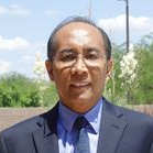
School of Geographical Sciences and Urban Planning, Arizona State University, Tempe, AZ 85287, USA <a href="https://sgsup.asu.edu/soe-myint">Website</a>
Soe W. Myint spent four years at the United Nations Environment Program – Environment Assessment Program for Asia and the Pacific as a research specialist before starting his doctorate. During his doctoral study, he was invited to serve as a consultant at the World Health Organization headquarters in Geneva, Switzerland.
He received an Outstanding Achievement Award (AAG-RSSG), Prominent Alumnus of Asian Institute of Technology, Best Paper Award for Early Career Scholars in Remote Sensing (American Association of Geographers), AITAA Distinguished Alumni Award (2007) for Academic and Research Excellence, USGS scholar award (International Conference on GIScience, 2000), Intergraph Young Scholar award (University Consortium for Geographic Information Science (UCGIS, 2002), and CPGIS Scholar, 2005 (selected by the Chinese Professionals in Geographic Information Science Abroad). He was nominated for the Zebulon Pearce Distinguished Teaching Award (tenured and tenure-track faculty members (2017) and invited as an Honored Guest (2009) by the College of Liberal Arts and Sciences, for making difference in multiple undergraduate students’ education. During his graduate studies, he received four best student paper awards and two 2nd-best paper awards at different national, international, and regional level professional meetings.
He has served as president, vice president, membership chair, and director of the American Society for Photogrammetry and Remote Sensing (ASPRS) - Pacific Southwest U.S. Region. He also served as chair, vice chair, and director of the American Association of Geographers (AAG) - Remote Sensing Specialty Group (RSSG) and is faculty sponsor of the ASU student chapter of the ASPRS. He has been serving as Editor-in-Chief of Urban Remote Sensing section, Remote Sensing journal.
He served as Fulbright Canada Research Chair in Water, Environment, and Clean Energy in fall 2019.
Important Dates

- Abstract submission deadlineNov 30, 2021
- Abstract acceptance notificationJan 14, 2022
- Registration end dateJan 18, 2022
- Early bird registration deadlineOct 31, 2021
- Regular registration deadlineJan 18, 2022




We are pleased to announce the winners of the Best Poster Award and Best Oral Presentation Award.
The Best Poster Award has been granted to:
Poster Session 1
(g) Lei Song
A super-ensemble approach to map land cover types with high resolution over data-sparse African savanna landscapes
Post Session 2
(a) Kateřina Fárová
Response of the SAR intensity to above-average air temperature recorded in the northern part of the Antarctic Peninsula in February and November 2020
Two best poster presentation with 50% discount on the APC in Remote Sensing and a certificate.
The Best Presentation Award has been granted to:
Session 1
- Mobile Laser Scanning data acquisition and pre-processing in Galicia Forests- Ana Novo
- NOAA series quadratic SW-LST algorithms analysis and evaluation: JPSS-1/NOAA-20 Algorithm proposal-Nisrine Chekroun
- SolarFarmNetwork - A Deep Learning Framework to Detect and Evaluate the Capacity of Solar Farms Using Satellite Imagery-Elaf AlMahmoud
Session 2
- Tropical Peatland Subsidence Monitoring by Time-Series InSAR for Evaluation of Peat Degradation in Indonesia-Dr. Yuta Izumi
Session 3
- Flood mapping using Sentinel-1 SAR imagery and the ESA SNAP S1 Toolbox- Luigi Selmi
Session 5
- Exploitation of multi-temporal PROBA V satellite data to establish the influence of Soil water on vitality of Tectona grandis L.: A case study of deciduous forest of Western, India-Ashwini Mudaliar
- Quantifying canopy nitrogen content and non-photosynthetic vegetation using hyperspectral PRISMA data in preparation for the upcoming Copernicus Hyperspectral Imaging Mission for the Environment (CHIME)- Jochem Verrelst
Session 6
- "Checks by Monitoring” through Copernicus Satellite Data: the new European Common Agricultural Policy Approach- Livio Rossi
- CAP Monitoring and Control Using SENTINEL Products And Services -Jesus Estrada
Each winner will receive 100 CHF and a certificate.
For your information, there will be live sessions on 25th, 26th, 27th January 2022.
Authors are encouraged to submit their abstracts. After Abstract Evaluation, some will be accepted to give a 3-5 minutes' Poster Presentation,some can be Selected Speakers and welcomed to give 10/15 min. talks for a live session.
Authors will be notified by 20 December 2021 if their abstracts are accepted.
The live session is offered via Zoom and registration is required for attendance. Please see the registration detail at the registration section.
Poster Session 1
Poster Session 2
Ms. Amiee Shi
Ms. Kristy Zhang
Ms. Gem Yao
MDPI Branch Office, Beijing
Email: ecrs2022@mdpi.com
For information regarding submission inquiry and sponsoring opportunities, please feel free to contact us.
We are pleased to announce that the First Photographic Exhibition is open for application for authors that have papers published in Remote Sensing. You can apply to exhibit a striking picture to summarize the content of your publication and represent the topic of the article in an attention-grabbing way, or an introduction video to show your published research. We believe that the exhibition will establish further communications between authors and readers.
The details about the application can be found in the following link:
https://www.mdpi.com/about/announcements/2341