
Topics Webinar | GeoAI – Prospects and Challenges II
the chair
GeoAI – Prospects and Challenges II
This webinar series represents a collection of online presentations that brings together scholars from around the world with expertise in the field of Geospatial Artificial Intelligence (GeoAI) and its diverse range of applications. The talks will provide an opportunity to share knowledge, exchange research ideas and discuss the emerging opportunities and challenges that GeoAI presents across different geospatial fields and application domains. Invited leading scholars will communicate their research results and share their perspectives and experiences on the current state and future directions of GeoAI.
MDPI has successfully hosted several well-received webinars in the Earth Observation & Geosciences (EOGEO) series, attracting thousands of researchers worldwide. Building on this momentum, we continue to collaborate with MDPI journals such as IJGI, Geomatics, Remote Sensing, Drones, Land, Fire, and Applied Science, to name a few, to promote high-quality academic exchanges in the fast-growing field of GeoAI.
Date: 28 September 2026
Time: 6:00 pm CEST | 9:00 am PDT
Webinar ID: 890 3081 2871
Webinar Secretariat: webinar@mdpi.com
Meet Our Chair

Geography Department, Simon Fraser University, Canada;Suzana Dragićević is a Professor in the Department of Geography and Director of the Spatial Analysis and Modeling (SAM) Research Laboratory at Simon Fraser University (SFU). She works within the multidisciplinary domains of geographic information systems and science (GIS), complexity science, geospatial artificial intelligence (GeoAI) and soft computing for the analysis and modeling of complex dynamic geospatial systems. She is a co-editor of the Springer book series on “Advances in Geographic Information Science” and is a member of numerous international journal editorial boards.
Meet Our Speakers

Department of Geography and Environmental Studies, Toronto Metropolitan University, Canada;Claus Rinner is a Professor, Undergraduate Program Director, and former Graduate Program Director and Chair in the Department of Geography and Environmental Studies at Toronto Metropolitan University (formerly Ryerson University). His research and teaching expertise is in the areas of Geographic Information Systems (GIS), Cartography, and Decision Support Systems, with applications in Public Health, Social Policy, and Environmental Planning. He initiated and led a collaborative New Frontiers in Research Fund (NFRF) project on post-pandemic recovery, held a Natural Sciences and Engineering Research Council (NSERC) Discovery Grants in the area of geospatial multi-criteria decision analysis, and participated in research funded by the Canadian Institutes of Health Research (CIHR), Social Sciences and Humanities Research Council (SSHRC), and Network of Centres of Excellence (NCE). Dr. Rinner features in Stanford University's ranking of the world's top scientists since the August 2021 update; his career-long publication record places him among the 2% most influential researchers in the field of Geological & Geomatics Engineering. His research impact is also reflected in a total of over 5,000 citations, an h-index of 31, and twelve publications with over 100 citations (Google Scholar as of September 2026).
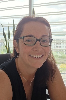
Department of Geography, Université de Montréal, Canada;Liliana Perez is a Full Professor in the Department of Geography at the Université de Montréal (UdeM) and the founder and director of the Laboratory of Environmental Geosimulation (LEDGE). She holds a PhD in Geography from Simon Fraser University (SFU) in Vancouver and has developed expertise at the intersection of spatial modelling and analysis, geosimulation, geospatial artificial intelligence (GeoAI), and environmental sciences. Her research draws on spatiotemporal modelling, geostatistics, artificial intelligence and machine learning, as well as spatial data mapping and visualization, and addresses a range of domains including landscape ecology, epidemiology, poverty, and socio-environmental dynamics. Her research program focuses on developing computational approaches to better understand the complexity of interactions between societies and their environments. In particular, she investigates the potential of geospatial artificial intelligence, machine learning, and agent-based models to analyze and simulate the evolution of these interactions across urban, forest, and wetland environments. Her current research focuses on developing algorithms for simulating spatial processes, integrating artificial intelligence methods into geographic models, and designing decision-support tools to explore alternative scenarios, support experimentation with geographic systems, and contribute to more sustainable management of territories and resources.
This is a FREE webinar. After registering, you will receive a confirmation email containing information on how to join the webinar. Registrations with academic institutional email addresses will be prioritized.
Certificates of attendance will be delivered to those who attend the live webinar.
Can’t attend? Register anyway and we’ll let you know when the recording is available to watch.
Register here for free!
Innovative Approaches in Geospatial Analysis and Modeling of Urban Environments
Edited by Dr. Shivanand Balram, Prof. Dr. Eric Vaz and Prof. Dr. Suzana Dragicevic
Abstract submission deadline 31 January 2027
Manuscript submission deadline 31 March 2027