Event submissions
Published
This submission belongs to the session S3. Remote sensing applications of the event The 5th International Electronic Conference on Remote Sensing
Published date
06 Nov, 2023
Academic Editor
'%3e%3cpath%20d='M12.6657%2010.9104C12.4185%2010.325%2012.0599%209.79327%2011.6097%209.34482C11.1609%208.89508%2010.6293%208.5365%2010.0442%208.28888C10.0389%208.28626%2010.0337%208.28495%2010.0285%208.28233C10.8446%207.69279%2011.3752%206.73249%2011.3752%205.64904C11.3752%203.8542%209.92103%202.39999%208.1262%202.39999C6.33136%202.39999%204.87715%203.8542%204.87715%205.64904C4.87715%206.73249%205.40774%207.69279%206.22393%208.28364C6.21869%208.28626%206.21345%208.28757%206.20821%208.29019C5.62129%208.5378%205.09463%208.89284%204.64265%209.34613C4.1929%209.79493%203.83432%2010.3266%203.58671%2010.9117C3.34345%2011.4845%203.21226%2012.0987%203.20023%2012.7209C3.19988%2012.7349%203.20233%2012.7488%203.20744%2012.7619C3.21255%2012.7749%203.22022%2012.7867%203.22998%2012.7968C3.23975%2012.8068%203.25142%2012.8147%203.26431%2012.8202C3.2772%2012.8256%203.29105%2012.8284%203.30504%2012.8284H4.09109C4.14874%2012.8284%204.19459%2012.7825%204.1959%2012.7262C4.2221%2011.7148%204.62823%2010.7676%205.34617%2010.0497C6.08899%209.30683%207.0755%208.89808%208.1262%208.89808C9.17689%208.89808%2010.1634%209.30683%2010.9062%2010.0497C11.6242%2010.7676%2012.0303%2011.7148%2012.0565%2012.7262C12.0578%2012.7838%2012.1037%2012.8284%2012.1613%2012.8284H12.9474C12.9613%2012.8284%2012.9752%2012.8256%2012.9881%2012.8202C13.001%2012.8147%2013.0126%2012.8068%2013.0224%2012.7968C13.0322%2012.7867%2013.0398%2012.7749%2013.0449%2012.7619C13.0501%2012.7488%2013.0525%2012.7349%2013.0522%2012.7209C13.0391%2012.0947%2012.9094%2011.4855%2012.6657%2010.9104ZM8.1262%207.9024C7.52486%207.9024%206.9589%207.6679%206.53312%207.24211C6.10733%206.81633%205.87283%206.25037%205.87283%205.64904C5.87283%205.0477%206.10733%204.48174%206.53312%204.05596C6.9589%203.63018%207.52486%203.39567%208.1262%203.39567C8.72753%203.39567%209.29349%203.63018%209.71927%204.05596C10.1451%204.48174%2010.3796%205.0477%2010.3796%205.64904C10.3796%206.25037%2010.1451%206.81633%209.71927%207.24211C9.29349%207.6679%208.72753%207.9024%208.1262%207.9024Z'%20fill='%235D1EE1'/%3e%3c/g%3e%3c/svg%3e) Giorgos Mallinis
Giorgos MallinisCitation
Enrique Casas, Rebecca Magdalena Kropp, Jose Angel Reyes Castro, Francisco Javier Díaz Peña, Manuel Arbelo, Probabilistic classification of infected palm trees using UAV-based multispectral imagery and machine learning, in Proceedings of The 5th International Electronic Conference on Remote Sensing, 7 November–21 November 2023, MDPI: Basel, Switzerland
Share
Email
Facebook
Twitter
LinkedIn
Probabilistic classification of infected palm trees using UAV-based multispectral imagery and machine learning
'%3e%3cpath%20d='M12.6647%2010.9104C12.4176%2010.325%2012.0589%209.7933%2011.6088%209.34485C11.16%208.89511%2010.6283%208.53653%2010.0432%208.28891C10.038%208.28629%2010.0327%208.28498%2010.0275%208.28236C10.8437%207.69282%2011.3743%206.73252%2011.3743%205.64907C11.3743%203.85423%209.92005%202.40002%208.12522%202.40002C6.33038%202.40002%204.87618%203.85423%204.87618%205.64907C4.87618%206.73252%205.40677%207.69282%206.22296%208.28367C6.21772%208.28629%206.21248%208.2876%206.20724%208.29022C5.62031%208.53783%205.09365%208.89287%204.64167%209.34616C4.19192%209.79496%203.83334%2010.3266%203.58573%2010.9117C3.34247%2011.4846%203.21128%2012.0987%203.19925%2012.721C3.1989%2012.735%203.20135%2012.7489%203.20646%2012.7619C3.21157%2012.7749%203.21924%2012.7868%203.22901%2012.7968C3.23877%2012.8068%203.25045%2012.8148%203.26334%2012.8202C3.27623%2012.8256%203.29007%2012.8284%203.30406%2012.8284H4.09012C4.14776%2012.8284%204.19362%2012.7825%204.19493%2012.7262C4.22113%2011.7148%204.62726%2010.7676%205.34519%2010.0497C6.08802%209.30686%207.07452%208.89811%208.12522%208.89811C9.17592%208.89811%2010.1624%209.30686%2010.9052%2010.0497C11.6232%2010.7676%2012.0293%2011.7148%2012.0555%2012.7262C12.0568%2012.7839%2012.1027%2012.8284%2012.1603%2012.8284H12.9464C12.9604%2012.8284%2012.9742%2012.8256%2012.9871%2012.8202C13%2012.8148%2013.0117%2012.8068%2013.0214%2012.7968C13.0312%2012.7868%2013.0389%2012.7749%2013.044%2012.7619C13.0491%2012.7489%2013.0515%2012.735%2013.0512%2012.721C13.0381%2012.0947%2012.9084%2011.4856%2012.6647%2010.9104ZM8.12522%207.90243C7.52388%207.90243%206.95792%207.66793%206.53214%207.24215C6.10636%206.81636%205.87185%206.2504%205.87185%205.64907C5.87185%205.04773%206.10636%204.48177%206.53214%204.05599C6.95792%203.63021%207.52388%203.3957%208.12522%203.3957C8.72655%203.3957%209.29252%203.63021%209.7183%204.05599C10.1441%204.48177%2010.3786%205.04773%2010.3786%205.64907C10.3786%206.2504%2010.1441%206.81636%209.7183%207.24215C9.29252%207.66793%208.72655%207.90243%208.12522%207.90243Z'%20fill='%235D1EE1'/%3e%3c/g%3e%3c/svg%3e)
Enrique Casas 1
Rebecca Magdalena Kropp 2
Jose Angel Reyes Castro 3
Francisco Javier Díaz Peña 2

Manuel Arbelo 1
1. Departamento de Física, Universidad de La Laguna, 38200 San Cristóbal de La Laguna, Spain
2. Departamento de Biología Animal, Edafología y Geología, Universidad de La Laguna, 38200 San Cristóbal de la laguna, Spain
3. Sección de Sanidad Vegetal, Dirección General de Agricultura, Consejería de Agricultura, Ganadería y Pesca,
47014 Santa Cruz de Tenerife, Spain
Abstract
Human activities have led to the global redistribution of species, causing a worldwide decline in biodiversity, followed by the apparition of non-native species in natural environments, jeopardizing the normal function of the ecosystems and the apparition of invasive pests and new pathogens to crops and forests. The Canarian archipelago landscape, shaped by Canarian palm tree (Phoenix canariensis) groves, is being affected by this phenomenon, with their consequent decline.
The European Union Natura 2000 protection areas designated Phoenix canariensis groves as a priority habitat as an essential endemic Canary Islands plant species, and in this context, new tools to monitor and treat the pathologies that affect this species.
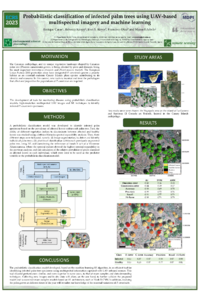
Traditional pathology diagnostic techniques are resource-demanding and poorly reproducible, and it is necessary to develop new monitoring methodologies. This study presents a tool to identify individuals infected by Serenomyces phoenicis and Phoenicococcus marlatti using UAV-derived multispectral images, machine learning, and probabilistic classification techniques. Two different study areas were selected in Tenerife and La Gomera islands, due to their representativity of the health status of Canarian palm groves.
In the first step, image segmentation was used to automatically identify palm tree specimens. In the second step, a pixel-based classification allowed us to assess the relative prevalence of affected leaves at an individual scale for each palm tree. The calculated affection prevalence ratio was later used alongside labelled in situ data depicting healthy and infected individuals, collected by expert technicians’ visual inspection to build a probabilistic classification model, capable of detecting infected specimens. Both the pixel classification performance and the model’s fitness were evaluated using different metrics such as omission and commission errors, accuracy, precision, recall, and F1-score.
An accuracy of more than 0.96 was obtained for the pixel classification of the affected and healthy leaves, and the probabilistic classification model presented good detection ability, reaching an accuracy of 0.87 for infected palm trees.
It is worth considering that the developed algorithms and the infection detection model could allow for the cost-effective identification of infected palm trees by implementing transfer learning procedures in new study areas. This will imply a drastic decrease in data requirements, facilitating future palm groves' extensive monitoring in the archipelago, and significantly reducing phytosanitary treatment costs.
Keywords
probabilistic classification modelling
support vector machine
random forest
spectral separability analysis
structure insensitive pigment index
NDVI
Canary Islands
Manuscript
poster_phoenix_2 v2.pdf
Poster
poster_phoenix_2 v2.pdf
Estimation of air temperature at sites in Maritime Antarctica using MODIS LST collection 6 data
Mapping aquatic phytoplankton blooms using Sentinel-2 satellite imagery.