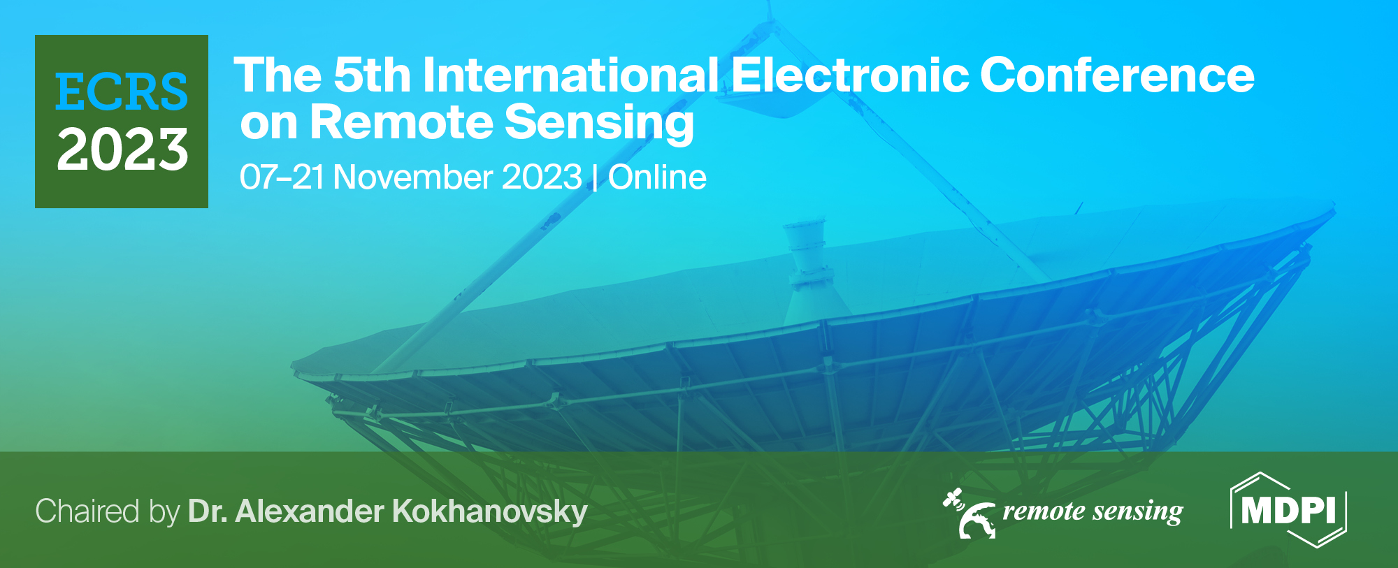
Please login first

List of accepted submissions


Show results per page
Find papers
 
  • Open access
  • 0 Reads
Normalized Burn Ratio and Land Surface Temperature in Pre- and Post- Mediterranean forests Fire

Fire is a natural disruption that affects the structure and function of forest systems by changing the vegetation composition, climatic situation, carbon cycle, wildlife habitat, and many other major properties. The measure of these changes’ degree is known as fire severity, and it can be assessed using remote sensing data (i.e., satellite images, aerial images, etc.) and various biophysical indices (such as Normalized Burn Ratio (NBR), Char Soil Index (CSI), Burn Area Index (BAI), etc.), in addition to the measurement of Land Surface Temperature (LST). This research aims to assess the response of NBR and LST in pre- and post-forest fire, taking as a study area, a Mediterranean forest located in the northern part of Morocco (35.1167° N, 5.7754° W), which burned in the summer of 2022. We used seven Landsat-8 images spanning three years: three images from 2021 (i.e., pre-fire), one image from the summer of 2022 (i.e., fire period), and three images from 2023 (i.e., post-fire). Results demonstrated a negative correlation between LST and NBR in the pre-fire period; when the temperature rises, the NBR drops. Same for the fire period in summer 2022, LST reached its peak at 50°C, while NBR decreased to its lowest point at -0.2. Whereas, in the recovery time (i.e., 2023), LST and NBR changed their fluctuation patterns; the first one variated normally according to seasons, dropping from the 50°C to 12°C in winter and reaching 37°C in summer, and the second one increased over time, going from the -0.2 to -0.04 in winter rising to 0.03 in summer, which indicates the gradual restoration of vegetation in the study area. The study concludes that in the post-fire period when the forest is recovering, NBR is unaffected by seasonal changes in temperature and is more reflective of the vegetation it projects more the vegetation situation in the area, unlike LST. Thus, relying only on LST to measure fire severity can give biased results due to changes in seasons.

  • Open access
  • 0 Reads
Analysis of Subglacial Lake Activity in Recovery Ice Stream with ICESat-2 Laser Altimetry

The Recovery Ice Stream is one of the longest ice streams in Antarctica, annually discharging a significant mass of ice into the Southern Ocean. Beneath the Recovery Ice Stream are numerous active subglacial lakes whose drainage and storage directly impact the flow velocity of the entire ice stream. This, in turn, has a considerable influence on ice dynamics, grounding line stability, and the mass balance of the East Antarctic Ice Sheet. Approximately twenty years ago, scientists discovered that the water transfer movements within subglacial lakes caused surface deformation on the ice sheet. The latest NASA Ice, Cloud, and Land Elevation Satellite-2 (ICESat-2), utilizing laser altimetry technology, can capture more dense and precise spatial details, helping us better understand this hydrological process. Based on this, we use all the ICESat-2 data from September 2018 to July 2022 to reconstruct and analyze the activity of subglacial lakes under the Recovery Ice Stream. To investigate water transfer between the subglacial lakes and the latest subglacial lake outlines, we calculate the differential between measurement points and the reference Digital Elevation Model (DEM) to depict the surface elevation changes of each active subglacial lake in monthly time steps. The new lake outlines are defined as contour lines representing the average elevation changes of the static ice sheet. After obtaining the lake outlines, we further analyze the crossover tracks to generate higher temporal resolution elevation change time series for the regions of interest. We have observed differences in the location and volume of the subglacial lake signals compared to the previously published inventory. Firstly, we discover that Lake REC1, originally considered as one lake, is composed of two distinct lakes during the study period, displaying opposing elevation change trends in repeated orbits. While the left area of the REC1 lake experienced a rise of 1m, the right area showed a decrease of approximately 0.5m. Additionally, through calculations of temporal elevation changes, REC1, REC2, and REC3 exhibited characteristics of cascading responses from upstream to downstream. The upstream lake, REC6, initially drained and has been continuously refilling since late 2019, resulting in a surface elevation change of approximately 4m and consuming nearly 0.4 km3 of subglacial water. This substantial water supply has effectively lubricated the ice-bedrock interface, facilitating the fast flow of the Recovery ice stream. Finally, we estimated the hydraulic head of the lakes and predicted water flow paths that align with the sequence of lake activity depicted in the time series plot. In conclusion, the subglacial lakes within the Recovery ice stream constitute a well-connected hydrological system, and the hydrological dynamics in this region are closely associated with the unique subglacial topography of the Recovery area.

  • Open access
  • 0 Reads
A first approximation for acid sulfate soil mapping in areas with few soil samples
, ,

Acid sulfate soil mapping is the first step to avoid possible environmental damages created by one of the most problematic soils existing in nature: the acid sulfate soils. This type of soil is especially hazardous when it is drained by agricultural or forestry land use. Nowadays, more objective and precise maps are possible thanks to the application of machine learning. The use of a supervised machine learning technique in acid sulfate soil mapping requires two different types of data: the soil samples and the environmental covariates created by remote sensing data. One of the problems in acid sulfate soil mapping is the lack of soil samples in some regions since the collection of soil samples and their analysis is a long process. This prevents the creation of acid sulfate soils occurrence maps. For a first recognition of these regions, in addition to using the remote sensing data of the area, a possible solution could be the use of soil samples from other areas with similar characteristics for training the model. The question is whether a machine learning model could correctly classify acid sulfate soils in an area where it has not been trained. If this were possible, this first prediction could be used to design an efficient sampling plan for the region. In previous works, Random Forest has shown high abilities for the correct prediction of acid sulfate soils. In this work, we analyze if Random Forest is able to correctly classify the soil samples in an area where it has not been trained. For this, two different regions located in southern Finland with a similar composition of their soils are considered. It is known that remote sensing data play a fundamental role in the detection of acid sulfate soils. In this study, the remote sensing data used are LiDAR and geophysics, which arise from airborne surveys. The raster data of both areas consist of 17 environmental covariates of different types: Quaternary geology, digital elevation model, terrain layers and aerogeophysics layers. Digital elevation model is made using LiDAR data, and the terrain layers are derived from the digital elevation model. In this work, we show that Random Forest is able to classify the acid sulfate soils of an area where it has not been trained. The precision of the model is above 60%. These results are very good for a model that has not been trained in the area of the prediction. Training the model in the same area improves the results by up to 10-13%. Therefore, training the model in a different region can be used for a first recognition of regions with limited soil samples as well as for the creation of the sampling plan design in those regions.

  • Open access
  • 0 Reads
Comparative Analysis of Summer Discomfort Index and Thermal Sensation Vote Using Remote Sensing Data in Summer: A Case Study of Mediterranean cities Seville, Barcelona, and Tetuan

As urban areas continue to expand, there is an increasing focus on enhancing the comfort of outdoor thermal conditions.

In this study, summer discomfort index (SDI) maps were created for Seville, Barcelona, in Spain and Tetuan in Morocco .
Both temperature and humidity, which are crucial components in determining thermal comfort and discomfort, are taken into account by SDI.

The calculations used substituted air temperature with land surface temperature data from the Moderate Resolution Imaging Spectroradiometer (MODIS) and humidity from weather stations, which were then compared to thermal sensation votes (TSV) gathered from surveys given to the residents.
Land surface temperatures are normally higher than air temperatures, but the resulting maps offered a close representation of thermal comfort.

The goal was to evaluate the thermal comfort levels in the chosen cities and investigate the relationship between the remotely sensed (SDI) and the reported thermal perception by the residents. We aimed to gain insights into urban thermal environments and their effects on human perception by integrating remote sensing data and subjective (TSV).

The visual maps offer an easily readable representation of thermal comfort and discomfort and can assist designers in creating better outdoor spaces that are tailored to the needs and comfort levels of residents in each unique city.

The method involved gathering and examining MODIS land surface temperature data, processing it, and calculating each city's (SDI) values. Votes on thermal comfort (TSV) were collected through a seven scale questionnaire-based survey and represented residents' individual experiences and perceptions.

The findings provide valuable insights into the thermal conditions and comfort levels experienced by residents during summer in Seville, Barcelona, and Tetuan. Remote sensing data enabled the creation of spatially explicit (SDI) maps, facilitating a detailed assessment of thermal comfort variations within and between the studied cities. Comparing the remotely sensed (SDI) with subjective (TSV) contributes to a comprehensive understanding of agreement or divergence between objective measurements and human perception.

By highlighting the importance of integrating remote sensing techniques and subjective assessments for evaluating thermal comfort in urban areas, this research advances the field of urban climate studies and its results have implications for urban planning, design, and the development of strategies to enhance thermal conditions and well-being of city residents.

  • Open access
  • 0 Reads
Empirical Study of PEFT techniques for Winter Wheat Segmentation
, , , ,

Parameter Efficient Fine Tuning (PEFT) techniques have recently experienced significant growth and have been extensively employed to adapt large vision and language models to various domains, enabling satisfactory model performance with minimal computational needs. However, despite these advancements, more research has yet to delve into potential PEFT applications in real-life scenarios, particularly in the critical domains of remote sensing and crop monitoring.

In the realm of crop monitoring, a key challenge persists in addressing the intricacies of cross-region and cross-year crop type recognition. The diversity of climates across different regions and the need for comprehensive, large-scale datasets have posed significant obstacles in accurately identifying crop types across varying geographic locations and changing growing seasons. This study seeks to bridge this gap by comprehensively exploring the feasibility of cross-area and cross-year out-of-distribution generalization using the State-of-the-Art (SOTA) wheat crop monitoring model.

This research mainly focuses on adapting the SOTA TSViT model, recently proposed in CVPR 2023, to address winter-wheat field segmentation, a critical task for crop monitoring and food security, especially following the Ukrainian conflict, given the economic importance of wheat as a staple and cash crop in various regions. This adaptation process involves integrating different PEFT techniques, including BigFit, LoRA, Adaptformer, and prompt tuning, each designed to streamline the fine-tuning process and ensure efficient parameter utilization.
By employing PEFT techniques, we achieved notable results comparable to those attained through Full Fine-Tuning methods while training only a mere 0.7% parameters of the whole TSViT architecture. More importantly, we accomplished the claimed performance using a limited subset of remotely labeled data. The in-house labeled dataset, referred to as the Lebanese Wheat dataset, comprises high-quality annotated polygons for wheat and non-wheat classes for the study area in Bekaa, Lebanon, with a total surface of 170 km², over five consecutive years from 2016 until 2020. Using a time series of multi-spectral Sentinel-2 images, our model achieved an 84% F1-score when evaluated on the test set, shedding light on the capacity of PEFT to drive accurate and efficient crop monitoring, tailored mainly for developing countries characterized by limited data availability.

We intend to publicly release the Lebanese winter wheat dataset, code repository, and model weights.

  • Open access
  • 0 Reads
Integration of Object-Oriented Remote Sensing and Machine Learning to Create Field Model for Optimized Regional Agricultural Management

In an era marked by tools like Artificial Intelligence (AI), Machine Learning (ML) and remote sensing (RS), agriculture is a primary beneficiary. These technologies help to optimize agricultural productivity, optimizing resource using and increase yield. They not only optimizing usage but also adapt to climate change and manage risks associated with agricultural practices become inevitable. Vegetation Indices (VI) such as Normalized Difference Vegetation Index (NDVI) are relatively simple and useful algorithms that can be used to implement precision agriculture (PA). Optical satellite images can sense the reflected lights coming from leaves which can provide various crop development information used to implement PA. Agriculture sector is important for regional economy. If managed properly, many problems related with this sector can be eliminated like climate change, environmental problems, and economic development. PA applications can be used to create regional management policies. Remote sensing of agriculture for regional management practices is the main component of this study. This study involves monitoring agricultural production both seasonally and daily using Sentinel-2 multispectral time-series data. Time-series images from 2017 to 2022 are analyzed to detect shifts in phenological dates of crops. To understand these shift, a combination of NDSI ( Normalized Difference Salinity Index), MSAVI (Modified Soil Adjusted Vegetation Index), NDVI and NDMI (Normalized Difference Moisture Index) is used. First, mean MSAVI is calculated by the year, and phenological dates are determined according to the mean MSAVI values. For the bare soil dates, NDSI were calculated to understand the change of soil salinity. For the specific dates, the field is mosaicked and polygonised for each year with the machine learning methods. For the dates of seed germination, MSAVI is used, and the same procedure is developed. For the start of season and the rest, NDVI and NDMI are used. These shifts are then modeled using ML algorithms, and predictions are made for the year 2023. With these significant, planning of agricultural events can be arranged optimally for the next crop season. This process helps for planning the schedule of agricultural production and assists in regional management practices. The second step is controlling mean VI values for the dates found in the previous step. For daily changes, object – oriented and pixel-based methods (land segmentation) for field model are used to trends in the field. The field model includes the characteristics of the field, and MSAVI, NDVI and NDMI are used. In PA, site specific solutions are extremely important to get the optimum results. By characterizing the field, site specific solutions can be applied. Vegetation Indices used to create these characteristics. Both image processing and machine learning algorithms are used. According to the findings, it will be possible to optimize inputs for agricultural production which helps to decide for regional agricultural management. Since agricultural events have a great effect on agricultural applications, using meteorological data is the main milestone to improve this study. Overall, this research aims to contribute to regional agricultural production and management modules by using remote sensing and machine learning technology.

  • Open access
  • 0 Reads
Satellite-based Analysis of Lake Okeechobee's Surface Water: Exploring Machine Learning Classification for Change Detection.
,

Water is an essential resource for the survival of living beings. Remote sensing serves as the best possible way to detect water bodies and monitor changes across time. With a surplus amount of remote sensing data, machine learning approaches have become an effective and efficient way to detect and monitor water bodies. This research focused on utilizing remote sensing and machine learning approaches to monitor changes in the surface water of Lake Okeechobee. Landsat-7 and Landsat-8 for 2002 and 2022 were used for this analysis. Further, we used Support Vector Machine (SVM) and Random Forest (RF) classification methods to compare the classification scheme and used appropriate metrics to compare their applicability for surface water detection.

For classification, all bands with three band rationing, namely Normalized Difference Water Index(NDWI), Modified Normalized Difference Water Index (MNDWI), and Normalized Difference Vegetation Index(NDVI) were used. Thus, we increased the independent variable for this model, keeping the response variable of water vs non-water areas. With an overall accuracy of 96%, SVM outperformed RF for the classification of Landsat images. The outcomes were consistent across both models, ensuring the reliability of the model along with its metrics. Both models gave an overall accuracy of more than 90% and a kappa coefficient of 0.80. Classified images were subtracted using image differencing techniques to track the change between 2002 and 2020 in Okeechobee Lake. This approach helped to assess change in lake water on a pixel-by-pixel basis. It generated images with three categories: increasing, decreasing, or no change. The SVM model suggested an increase in lake water area in 20 years by 2,1515.11 acres and decreased by 563.10 acres.

On the other hand, RF predicted an increase in lake water area by 14947.13 acres and a decrease of 2138.32 acres in the last two decades. This research can explain the changing nature of lake areas. The water management plan adopted in the southern region of Okeechobee can be a reason for this change, where they drain more water to make land available for agriculture. The insights from this research provided a foundation for further advancements in environmental assessment and sustainable water resource planning, encouraging continued exploration of innovative methodologies to address complex ecological challenges effectively.

  • Open access
  • 0 Reads
Spatiotemporal Analysis of Land Surface Temperature in Response to Land Use and Land Cover Changes: A Remote Sensing Approach
,

Urbanization has introduced substantial and rapid uncontrolled Land Use and Land Cover (LULC) changes often in the global south, considerably affecting Land Surface Temperature (LST) patterns. Understanding this relationship between LULC changes and LST is crucial for effective urban planning and environmental management, particularly in the face of escalating climate change. This study aims to elucidate the spatiotemporal variations in LST in urban areas compared to LULC changes through remote sensing techniques. The study focused on a peripheral urban area of Phnom Penh (Cambodia) undergoing rapid development, using 462 Landsat images from 2000 to 2021. The analysis employed an exploratory time-series analysis of LST and examined areas with consistently higher LST (hotspots) regarding LULC changes.

The study revealed noticeable spatiotemporal variability in LST (20 to 69°C), predominantly influenced by seasonal patterns and LULC changes. The results showed a robust influence of seasons on LST dynamics, with marked fluctuations aligning with dry and rainy periods. We identified thermal hotspots and found these areas could guide targeted urban planning strategies to mitigate thermal discomfort. Furthermore, examining these hotspots provided insights into how LST varies within different LULCs at the exact geographical locations over the study period. The observed correlation between LULC changes and LST variations underscored the strong impact of urban development on local microclimates. These changes did not manifest uniformly but displayed site-specific responses to LULC changes, warranting the attention of urban planners, policymakers, and researchers.

These findings highlight the importance of considering the local context and specific LULC changes in planning strategies to mitigate the negative impacts of urban-induced LST increases. This study contributes to understanding the relationship between LST and LULC changes, demonstrating the potential for developing new models that account for this complex interplay. While the study focused on a specific urban area, the methodology provides a replicable model for other regions, potentially inspiring future research in various urban contexts.

  • Open access
  • 0 Reads
Temporal variations of mixing layer in rural environment according to different cloud conditions using a Campbell ceilometer CS135: Preliminary results
,

The mixed layer height (MLH) is an important parameter of the planetary boundary layer (PBL) because it significantly affects the transportation and dispersion processes of pollutants emitted from different sources. Its estimation can be identified by different physical indicators. Automatic lidar-ceilometers ALC) with their compact design, and the high range resolution (∼10 m) make them advantageous to many of the alternative systems for the MLH estimation.

The scope of the study is to analyze the variations of the MLH under different cloud conditions in daily and monthly basis. For this scope the data of the first five months from the Campbell ceilometer CS135 were analyzed. The instrument is operating in a rural place of Euboia Island (Greece) and the study presents preliminary results about the atmospheric profile of this area which is also related with the air transport of the largest airport in Greece (Athens airport).

  • Open access
  • 0 Reads
Assessment of Outdoor Thermal Comfort during the last decade Using Landsat 8 Imageries with Machine Learning Tools over the Three Metropolitan Cities of India
,

Since there is rapid expansion of urban areas and significant growth in urban populations, there is a pressing need to accurately assess changes in land use and land cover (LULC). Such changes play a pivotal role in predicting outdoor thermal comfort. Alterations in LULC can considerably impact local meteorological conditions, subsequently affecting thermal comfort. Thus, we endeavoured to investigate the spatial patterns in outdoor thermal comfort across the cities of Hyderabad, Bangalore, and Jaipur.

To achieve this, we utilized high-resolution imagery from Landsat 8 along with on-site meteorological data. The Support Vector Machine (SVM) incorporating principal component analysis (PCA) was used to estimate Thermal comfort. Seven environmental indices—namely, normalized difference vegetation index (NDVI), normalized difference water index (NDWI), new built-up index (NBI), land surface temperature (LST), brightness, greenness, and wetness—were used as independent variables. Addressing the issue of multi-collinearity among these variables was accomplished through PCA. LULC classification was performed by the decision tree method.

The LULC analysis unveiled intriguing trends. In Hyderabad, the proportion of built-up areas surged from 37% to 48% between 2009 and 2019, while barren lands notably diminished from 42% to 18%. Water bodies maintained a consistent coverage of around 3%. Notably, vegetation expanded from 20% to 30%, with the northwestern part becoming more verdant and the southern region becoming more urbanized. Similarly, in Bangalore, built-up areas escalated from 25% to 80%, resulting in a substantial loss of vegetation (25% to 2%) and a reduction in bare lands (50% to 18%). While water bodies experienced a minor decrease, the trend was noticeable. In Jaipur, built-up areas increased by approximately 12%, accompanied by a marginal uptick in greenery. Water bodies, however, remained almost negligible within the city.

The outcomes of the thermal comfort analysis demonstrated that the most pronounced urbanization transpired in Bangalore, whereas Jaipur exhibited the least urban expansion. Discomfort levels were highest in bare lands, followed by urban areas, vegetation zones, and water bodies. During the summers from 2009 to 2019, Hyderabad encountered varying degrees of discomfort, with Bangalore also witnessing similar conditions, and Jaipur experiencing discomfort most of the time. However, during the winter seasons, Bangalore transitioned from neutral to comfortable conditions, while Hyderabad and Jaipur predominantly maintained neutral levels of comfort.

Top