
NDT Webinar | Challenges in DRR: Is AI the Ultimate Solution?
the chair
6th Webinar on NDT
Challenges in DRR: Is AI the Ultimate Solution?
Artificial intelligence (AI) and remote sensing (RS) offer transformative potential for disaster risk reduction (DRR), yet their implementation faces significant hurdles. Key challenges include the scarcity of high-quality labeled datasets for training AI models, particularly for infrequent but high-impact disasters. Remote sensing data, while valuable, often suffers from inconsistencies due to cloud cover, sensor limitations, or low temporal resolution, which can affect real-time monitoring and emergency response.
In this webinar, Dr. David Daou will reflect on a central question: Is AI the ultimate solution for DRR? His presentation will explore the limitations of AI-driven predictive models, including issues with generalizability across diverse geographic and climatic conditions and the computational bottlenecks that can delay decision-making during fast-evolving disaster scenarios.
Further challenges include the technical complexity of integrating multi-modal RS data—such as thermal, radar, and hyperspectral imagery—requiring advanced data-fusion techniques. Ethical and governance concerns, including algorithmic bias and data privacy, also pose serious considerations. Finally, the lack of technical infrastructure and expertise in many high-risk regions limits the effective deployment of these advanced tools.
This session will highlight the need for collaborative efforts focused on enhancing data accessibility, developing adaptive AI systems, and strengthening local capacities—key steps toward bridging the gap between innovation and practical disaster resilience.
Date: 14 July 2025
Time: 9:00 am EDT | 3:00 pm CEST | 9:00 pm CST Asia
Webinar ID: 824 7503 5782
Webinar Secretariat: journal.webinar@mdpi.com
Meet Our Chair
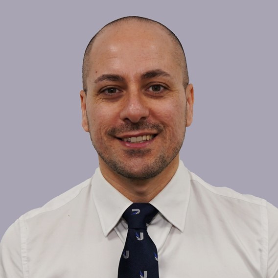
School of Computing and Engineering, University of West London, Room BY.03.19, St. Mary’s Rd., Ealing, London W5 5RF, UK;The Faringdon Research Centre for Non-Destructive Testing and Remote Sensing, University of West London, Room BY.GF.015, St. Mary’s Rd., Ealing, London W5 5RF, UK;Prof. Dr. Fabio Tosti is a Registered Chartered Engineer, a Professor of Civil Engineering at the School of Computing and Engineering, University of West London (UWL), London, U.K., and the Director of “The Faringdon Research Centre for Non-Destructive Testing and Remote Sensing” at UWL. His research interests include the development of new algorithms, methodologies, and models for geoscience applications and the non-destructive and remote sensing assessment of civil and green infrastructure, as well as cultural heritage. He has authored/co-authored over 250 research publication records and delivered numerous keynote speeches and invited lectures. Prof. Tosti was a recipient of the ECSs Award, presented by the European Geosciences Union (EGU), in 2017 and several Best Paper Awards at international conferences, including the TSP 2020, IEEE AGERS 2021, and GIRST 2023. He was the General Co-Chair of the Int. Workshop on Signal Processing Techniques for GPR Applications (SPT4GPRA) in 2024, 2022, and 2020. He has also led technical sessions at over 50 international conferences. He is the Founding Editor-in-Chief of NDT (MDPI) and an Associate Editor of various international peer-reviewed journals.
Meet Our Speaker
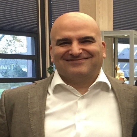
Institute for Environment and Human Security, United Nations University, Bonn, Germany;Dr. David Daou leads the AI and remote sensing team at UNU-EHS; he is the UNU-EHS AI representative and is a member of the scientific committee of UNU AI Global Network. His research interests include AI and climate risk modelling, the development of new algorithms, and the synergy of AI and remote sensing development applied to climate change, climate adaptation, and disasters risks. He has authored/co-authored over 50 research publication records and delivered numerous keynotes and invited lectures. He has worked with several space agencies, developed algorithms for the satellite EarthCARE ATLID lidar, and spent many years of his scientific career working on developing inversion methods for satellite and ground-based lidar. He particularly worked with AEROCAN, EARLINet, and CORALNet. Currently, at UNU-EHS, he is focusing more on serving the people by combining AI, remote sensing, and social media to understand and improve early-warning systems.





In this section, you will find the recordings of this webinar to watch, re-watch and share with your colleagues!