
Topics Webinar| Leveraging AI: Integrating Remote Sensing, GIS, and Machine Learning for Natural Disaster Resilience
the chair
Leveraging AI: Integrating Remote Sensing, GIS, and Machine Learning for Natural Disaster Resilience
Dear Colleagues,
It is a pleasure to welcome you to this webinar entitled, "Leveraging AI: Integrating Remote Sensing, GIS, and Machine Learning for Natural Disaster Resilience," hosted by Remote Sensing, Drones, Land, IJGI, and Geomatics. We are excited to bring together a remarkable group of experts and innovators from around the world to tackle one of today’s critical challenges: building resilience against natural hazards through the power of advanced technology.
Natural hazards, including earthquakes, floods, landslides, volcanic eruptions, wildfires and droughts, have profound impacts on communities, leading to devastating financial and human losses. Today, we will dive into the latest breakthroughs in technology, where machine learning (ML), remote sensing (RS), and geographic information systems (GIS) are reshaping how we approach these complex challenges. This session will highlight ML methods that draw meaningful insights from large data sets, transforming raw information into valuable knowledge. GIS adds a vital dimension to these insights, providing powerful tools for spatial analysis and visualization. In addition, with recent advances in deep learning, ensemble methods, evolutionary algorithms, and explainable AI (XAI), the capabilities of hazard prediction and preparedness have never been more promising.
Our aim is to foster connections, spark new ideas, and explore how these innovative approaches are transforming hazard mapping, monitoring, and assessment. Thank you for being part of this crucial journey. I hope you have an inspiring day filled with insights, collaboration, and discovery.
Warm regards,
Dr. Paraskevas Tsangaratos
Date: 11 December 2024
Time: 9:00 am CET | 4:00 pm CST Asia | 10:00 am EET
Webinar ID: 843 0771 3005
Webinar Secretariat: journal.webinar@mdpi.com
Meet Our Chair

Department of Geological Studies, School of Mining and Metallurgical Engineering, National Technical University of Athens, Athens, Greece;Dr. Paraskevas Tsangaratos serves as an Assistant Professor in Geoinformatics within the field of Geological Science, specializing in geohazards at the National Technical University of Athens and the School of Mining and Metallurgical Engineering. He holds a Mining Engineering Diploma and a Ph.D degree from the School of Mining and Metallurgical Engineering. He teaches Programming, GIS, artificial intelligence and machine learning, management of natural disasters and engineering geology. His main research interest and activity is focused on application of statistical/probabilistic methods and advanced spatial analysis techniques, soft computing, artificial intelligence, machine learning and deep learning in geosciences. Particular emphasis is placed on the study and management of geohazards, the recognition of the mechanisms and causes of their occurrence, as well as the application of methods and techniques to minimize the adverse effects of their occurrence. He has participated as researcher in more than 22 research programs funded by the European Union, the Greek government, and private sources. He has published more than 100 publications in leading scientific journals and international and national scientific conferences
Important Dates
11 Dec
2024
Meet Our Speakers
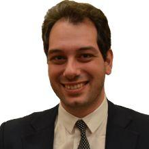
School of Engineering, University of Basilicata, Potenza, Italy;Dr. Raffaele Albano is a Professor of Hydrology, Hydraulics, and Hydraulic Constructions at the School of Engineering, University of Basilicata, Potenza (IT). Dr. Albano's interdisciplinary research spans engineering, socio-economic, and environmental issues, with a strong focus on hydrology and hydraulic constructions. He has authored over 40 scientific articles in leading journals (Scopus ID: 54963014000) and numerous contributions to national and international conferences, as well as scientific book chapters. His recent research areas include hydrological and hydrodynamic monitoring and modeling, flood risk and water resource management, artificial intelligence techniques, GIS and remote sensing methods, and system dynamic modeling.

School of Geographic Sciences, Nanjing University of Information Science and Technology, Nanjing, China;Dr. Haoyuan Hong received his B.S. degree in geographic information systems and his M.S. degree in climate systems and global change from Nanjing University of Information Science and Technology, Nanjing, China, in 2007 and 2011, respectively. He holds a Geography Diploma and completed his Ph.D degree at the Department of Geography and Regional Research, University of Vienna, Vienna, in 2022. His research interests include machine learning, GIS, and natural hazard assessment.

Department of Civil & Environmental Engineering, University of Cyprus, Nicosia, Cyprus;Dimitrios Loukidis is an Associate Professor of geotechnical engineering at the Department of Civil & Environmental Engineering of the University of Cyprus. He has performed research on slope stability and landslides, foundation engineering, the constitutive modeling of soils, the impact of seismic faults on pipelines, and the simulation of large deformation problems in geotechnical engineering. He has offered consulting services on landslide analysis and stabilization in Cyprus. Loukidis has been head of the Geomechanics Laboratory of the University of Cyprus since 2009. He is currently serving as Chair of the Department of Civil & Environmental Engineering of the University of Cyprus.






The webinar was hosted via Zoom and required registration to attend. The full recording can be found below. In order to learn about future webinars, you can sign up to our newsletter by clicking “Subscribe” at the top of the page.
Edited by Dr. Paraskevas Tsangaratos, Dr. Wei Chen, Dr. Ioanna Ilia and Dr. Haoyuan Hong
Deadline for manuscript submissions: 31 December 2024
Unmanned Aerial Systems (UAS) for Global Challenges: Current Technologies and Future Prospects
Edited by Dr. Bashar Alsadik, Prof. Dr. Francesco Nex, Prof. Dr. Fabio Remondino and Dr. Jesús Balado Frías
Deadline for manuscript submissions: 31 December 2024
Advances in Remote Sensing and GIS for Natural Hazards Monitoring and Management
Edited by Dr. Adrianos Retalis and Dr. Dimitrios D. Alexakis
Deadline for manuscript submissions: 31 December 2024
Artificial Intelligence for Soil Erosion Prediction and Modeling
Edited by Dr. Nikiforos Samarinas, Dr. Nikolaos L. Tsakiridis, Dr. Nikolaos Tziolas and Dr. Ioannis N. Daliakopoulos
Deadline for manuscript submissions: 3 April 2025
Article Published by Geomatics
Authors: Pavlos Krassakis, Andreas Karavias, Paraskevi Nomikou, Konstantinos Karantzalos, Nikolaos Koukouzas, Stavroula Kazana and Issaak Parcharidis
Geomatics 2022, 2(3), 297-322; https://doi.org/10.3390/geomatics2030017