Topics Webinar | EO&GEO Series: Cultural Heritage Mapping and Monitoring
the chair
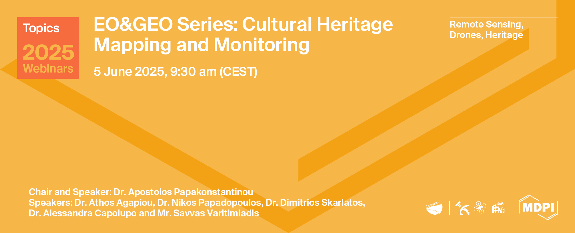
EO&GEO Series: Cultural Heritage Mapping and Monitoring
We are delighted to welcome you to the webinar “Cultural Heritage Mapping and Monitoring,” organized under the framework of the COASTLINE project (HORIZON-MSCA-2022-SE). This workshop brings together a diverse community of experts from universities, research centers, and SMEs, all actively engaged in the documentation, analysis, and preservation of cultural heritage through advanced mapping and monitoring techniques.
The program features presentations on Earth Observation applications, geophysical prospection, coastal bathymetry, and multi-source geoinformatics workflows. It also highlights innovative visualization tools, including drone-based imaging, virtual reality (VR), and augmented reality (AR), offering immersive experiences for cultural heritage interpretation.
A dedicated dissemination session will provide valuable insights into the MSCA Staff Exchanges and the integration of Open Science practices in research projects.
We look forward to your active participation in this collaborative and knowledge-rich event.
Date: 5 June 2025
Time: 9:30 am CEST | 3:30 pm CST Asia
Webinar ID: 879 4605 8203
Webinar Secretariat: journal.webinar@mdpi.com
Meet the Event Chair

Meet Our Speakers
Dr. Athos Agapiou
Department of Civil Engineering and Geomatics, School of Engineering and Technology, Cyprus University of Technology, Cyprus;
Dr. Athos Agapiou obtained his diploma from the School of Rural and Surveying Engineering at the National Technical University of Athens (2005). Two years later, in 2007, he obtained an MSc in geoinformatics from the same university. Also, he holds an MΑ from the Department of History and Archaeology of the University of Cyprus (2010), while in 2013, he received his PhD in the field of remote sensing archaeology. Since 2021, he has been an assistant professor in the Department of Civil Engineering and Geoinformatics of the Cyprus University of Technology, holder of the "Geoinformatics and Earth Observation" chair, while at the same time, he is the coordinator of the research activities of the EOCult laboratory. Since 2022 he has been the Deputy Director of the UNESCO Chair of "Digital Cultural Heritage". His scientific interests include the fields of Earth observation and geoinformatics for archaeological research and cultural heritage landscapes.
Dr. Nikos Papadopoulos
Institute for Mediterranean Studies (IMS), Foundation for Research & Technology Hellas (FORTH), Greece;
Nikos Papadopoulos holds BSc in Geology (2001) and PhD (2007) in Applied Geophysics from the University of Thessaloniki (Greece). He was a post-doctoral researcher in the Korea Institute of Geoscience and Mineral Resources, KIGAM (2008) and Visiting Fellow Researcher in University of Arkansas, USA (2013). He joined the Foundation for Research and Technology, Hellas (FORTH) in 2009 where he is currently Research Director of Applied Geophysics in Cultural Heritage and head of the Laboratory of Geophysical–Satellite Remote Sensing & Archaeoenvironment (GeoSat ReSeArch Lab). His research interests include the numerical modeling and inversion of resistivity tomographic data, the implementation of diverse geophysical methods for near surface archaeological, environmental, urban, shallow marine applications and the employment of geoinformation technologies in cultural and natural resources management. He has participated and/or organized in more than 145 geophysical projects in Greece, Cyprus, Hungary, Egypt, USA, Australia and S. Korea and has been the coordinator/main researcher in more than 45 National and EU funded large scale projects. He is Associate Editor of Journal of Archaeological Prospection and Near Surface Geophysics and Topic/Guest Editor in Remote Sensing.
Dr. Dimitrios Skarlatos
Department of Civil Engineering and Geomatics, School of Engineering and Technology, Cyprus University of Technology, Cyprus;
Dr. Dimitrios Skarlatos is Professor in the department of Civil Engineering and Geomatics in Cyprus University of Technology, currently he serves as the Vice Dean of the Faculty of Engineering and Technology. He holds a Dipl. Eng. in Rural Surveying from National Technical University of Athens (NTUA), M.Sc. with distinction from University College London (UCL) and a Ph.D. from NTUA in digital photogrammetry. During his studies, he earned various scholarships and awards. He is member in several professional and scientific committees. He has served as member of board in Hellenic Society of Photogrammetry and Remote Sensing (2003-2019), and Vice President of Cypriot Association of Rural and Surveying Engineers for one term (2014-2016). He is the academic representative of Cyprus in EuroSDR (since 2010), co-chair in International Society of Photogrammetry and Remote Sensing, Commission II (2016-2026), Working Group 7 Underwater Data Acquisition and Processing. He is Chair of the Commission of Technologies for Cultural Heritage Geometric Documentation in the Executive Board of CIPA (under ICOMOS & ISPRS) for the period 2024-2028.
His main research interests focus on the acquisition and processing of 3D data and point clouds using image sequences. This includes underwater UAV or close-range photos. Apart from image-based techniques, 3D data acquisition is extended using handheld or terrestrial laser scanning.

Dr. Alessandra Capolupo
Department of Civil, Environmental, Land, Construction and Chemistry (DICATECh), Politecnico di Bari, Italy;
Alessandra Capolupo is Assistant Professor of Geomatics at the Politecnico di Bari, Italy. Her research focuses on the integration of remote sensing, photogrammetry, and cartography to support environmental monitoring, sustainable resource management, and climate risk assessment. She has developed innovative methodologies that combine satellite data with RPAS, aerial imagery, and GNSS measurements to perform multi-scale analyses of terrestrial systems.
She has contributed to numerous national and international research projects, advancing geospatial tools aimed at enhancing environmental resilience. Her expertise includes the use of advanced geospatial software and cloud-based platforms such as Google Earth Engine to process and analyse large-scale environmental datasets.
Alessandra is the author of several peer-reviewed publications in SCOPUS and ISI-indexed journals. Her work has been recognized with multiple academic awards, including Best Paper and Young Scientist distinctions, as well as recognition among the Top Reviewers in her field. Her research bridges the gap between Earth Observation science and real-world applications, promoting sustainable development and climate-smart decision-making.

Dr. Apostolos Papakonstantinou
Department of Civil Engineering and Geomatics, School of Engineering and Technology, Cyprus University of Technology, Cyprus;
Dr. Apostolos Papakonstantinou is an Assistant Professor in Cartography and Geoinformatics at the Department of Civil Engineering and Geomatics, School of Engineering and Technology, Cyprus University of Technology. He holds a PhD in Cartography & Geoinformatics from the University of the Aegean, where he specialized in scale issues in geovisualization. He also holds an MSc in Cultural Informatics and Communication and a BSc in Physics. His research focuses on cartographic and geovisualization methods using UAVs and airborne sensors for 2D and 3D mapping of spatiotemporal and environmental phenomena. He is leading the CartoGI Lab (Cartography and Geovisualization) research and is the coordinator of the COASTLINE MSCA SE project. His research interests include UAV mapping, 2D-3D geovisualization, GeoAI applications for automated mapping and change detection.
Mr. Savvas Varitimiadis
Aegean Solutions S.A., Greece.;
Savvas is a cultural informatics specialist and a field archaeologist. He holds a bachelor’s degree in history and Archaeology of the Aristotle University of Thessaloniki, Faculty of Philosophy. Also holds two masters: one in cultural informatics, University of Aegean and one in Information Systems, University of Macedonia.
From 2006 works at the IT company Aegean Solutions S.A. as a specialist in project management, content writing, digitization and digital editing. Also, he is an expert in planning and developing web portals and digital mobile applications mostly for cultural heritage organizations, museums and touristic sites.
His recent scientific interests are the use of VR/AR applications in the cultural heritage sector, semantic web, ontologies, knowledge graphs and the development of AI chatbots for cultural heritage organizations. He is a PhD candidate at the University of the Aegean, Department of Cultural Technology and Communication, and a member of i-Lab.
Sponsors and Partners
Organizer


Media partner


In this section, you will find the recordings of this webinar to watch, re-watch and share with your colleagues!
Thank you to everyone who joined us for the successful webinar on Cultural Heritage Mapping and Monitoring, which was organized as part of the COASTLINE project in collaboration with the Remote Sensing Journal MDPI. It provided a fantastic opportunity to explore innovative geospatial methods, share valuable insights, and connect with experts from various disciplines. We look forward to your participation in our next COASTLINE Project Series webinar as we continue to explore the intersection of geospatial innovation and the preservation of coastal cultural heritage.
Assessing Stone Material Recession of Cultural Heritage: New Approach Based on Satellite-Based Rainfall Data and Dose-Response Functions—Case of UNESCO Site of Matera"Innovative UAV and Satellite Technologies and Applications for Spatiotemporal Analysis
Remote Sens. 2025, 17(8), 1443
Imaging Cultural Heritage at Different Scales: Part II, the Meso-Scale (Sites)
Remote Sens. 2025, 17(4), 598
SfM Photogrammetry for Cost-Effective 3D Documentation and Rock Art Analysis of the Dombate Dolmen (Spain) and the Megalithic Sites of Chã dos Cabanos and Chã da Escusalha (Portugal)
Remote Sens. 2024, 16(18), 3480
"Innovative UAV and Satellite Technologies and Applications for Spatiotemporal Analysis "
Edited by Dr. Apostolos Papakonstantinou, Prof. Eufemia Tarantino, Dr. Alessandra Capolupo and Dr. Athos Agapiou