Event submissions
Events2nd Conference on Future Challenges in Sustainable Urban Planning & Territorial Management
Published
This submission belongs to the session TM. Territorial management of the event 2nd Conference on Future Challenges in Sustainable Urban Planning & Territorial Management
Published date
28 Jan, 2024
Academic Editor
'%3e%3cpath%20d='M12.6657%2010.9104C12.4185%2010.325%2012.0599%209.79327%2011.6097%209.34482C11.1609%208.89508%2010.6293%208.5365%2010.0442%208.28888C10.0389%208.28626%2010.0337%208.28495%2010.0285%208.28233C10.8446%207.69279%2011.3752%206.73249%2011.3752%205.64904C11.3752%203.8542%209.92103%202.39999%208.1262%202.39999C6.33136%202.39999%204.87715%203.8542%204.87715%205.64904C4.87715%206.73249%205.40774%207.69279%206.22393%208.28364C6.21869%208.28626%206.21345%208.28757%206.20821%208.29019C5.62129%208.5378%205.09463%208.89284%204.64265%209.34613C4.1929%209.79493%203.83432%2010.3266%203.58671%2010.9117C3.34345%2011.4845%203.21226%2012.0987%203.20023%2012.7209C3.19988%2012.7349%203.20233%2012.7488%203.20744%2012.7619C3.21255%2012.7749%203.22022%2012.7867%203.22998%2012.7968C3.23975%2012.8068%203.25142%2012.8147%203.26431%2012.8202C3.2772%2012.8256%203.29105%2012.8284%203.30504%2012.8284H4.09109C4.14874%2012.8284%204.19459%2012.7825%204.1959%2012.7262C4.2221%2011.7148%204.62823%2010.7676%205.34617%2010.0497C6.08899%209.30683%207.0755%208.89808%208.1262%208.89808C9.17689%208.89808%2010.1634%209.30683%2010.9062%2010.0497C11.6242%2010.7676%2012.0303%2011.7148%2012.0565%2012.7262C12.0578%2012.7838%2012.1037%2012.8284%2012.1613%2012.8284H12.9474C12.9613%2012.8284%2012.9752%2012.8256%2012.9881%2012.8202C13.001%2012.8147%2013.0126%2012.8068%2013.0224%2012.7968C13.0322%2012.7867%2013.0398%2012.7749%2013.0449%2012.7619C13.0501%2012.7488%2013.0525%2012.7349%2013.0522%2012.7209C13.0391%2012.0947%2012.9094%2011.4855%2012.6657%2010.9104ZM8.1262%207.9024C7.52486%207.9024%206.9589%207.6679%206.53312%207.24211C6.10733%206.81633%205.87283%206.25037%205.87283%205.64904C5.87283%205.0477%206.10733%204.48174%206.53312%204.05596C6.9589%203.63018%207.52486%203.39567%208.1262%203.39567C8.72753%203.39567%209.29349%203.63018%209.71927%204.05596C10.1451%204.48174%2010.3796%205.0477%2010.3796%205.64904C10.3796%206.25037%2010.1451%206.81633%209.71927%207.24211C9.29349%207.6679%208.72753%207.9024%208.1262%207.9024Z'%20fill='%235D1EE1'/%3e%3c/g%3e%3c/svg%3e) Salvador Garcia-Ayllon
Salvador Garcia-AyllonCitation
Angela Franco, Urban policies during the last four decades have influenced the risk of flooding in Cartagena (Spain): A retrospective spatial analysis., in Proceedings of 2nd Conference on Future Challenges in Sustainable Urban Planning & Territorial Management, 29 January–31 January 2024, MDPI: Basel, Switzerland
Share
Email
Facebook
Twitter
LinkedIn
Urban policies during the last four decades have influenced the risk of flooding in Cartagena (Spain): A retrospective spatial analysis.
'%3e%3cpath%20d='M12.6647%2010.9104C12.4176%2010.325%2012.0589%209.7933%2011.6088%209.34485C11.16%208.89511%2010.6283%208.53653%2010.0432%208.28891C10.038%208.28629%2010.0327%208.28498%2010.0275%208.28236C10.8437%207.69282%2011.3743%206.73252%2011.3743%205.64907C11.3743%203.85423%209.92005%202.40002%208.12522%202.40002C6.33038%202.40002%204.87618%203.85423%204.87618%205.64907C4.87618%206.73252%205.40677%207.69282%206.22296%208.28367C6.21772%208.28629%206.21248%208.2876%206.20724%208.29022C5.62031%208.53783%205.09365%208.89287%204.64167%209.34616C4.19192%209.79496%203.83334%2010.3266%203.58573%2010.9117C3.34247%2011.4846%203.21128%2012.0987%203.19925%2012.721C3.1989%2012.735%203.20135%2012.7489%203.20646%2012.7619C3.21157%2012.7749%203.21924%2012.7868%203.22901%2012.7968C3.23877%2012.8068%203.25045%2012.8148%203.26334%2012.8202C3.27623%2012.8256%203.29007%2012.8284%203.30406%2012.8284H4.09012C4.14776%2012.8284%204.19362%2012.7825%204.19493%2012.7262C4.22113%2011.7148%204.62726%2010.7676%205.34519%2010.0497C6.08802%209.30686%207.07452%208.89811%208.12522%208.89811C9.17592%208.89811%2010.1624%209.30686%2010.9052%2010.0497C11.6232%2010.7676%2012.0293%2011.7148%2012.0555%2012.7262C12.0568%2012.7839%2012.1027%2012.8284%2012.1603%2012.8284H12.9464C12.9604%2012.8284%2012.9742%2012.8256%2012.9871%2012.8202C13%2012.8148%2013.0117%2012.8068%2013.0214%2012.7968C13.0312%2012.7868%2013.0389%2012.7749%2013.044%2012.7619C13.0491%2012.7489%2013.0515%2012.735%2013.0512%2012.721C13.0381%2012.0947%2012.9084%2011.4856%2012.6647%2010.9104ZM8.12522%207.90243C7.52388%207.90243%206.95792%207.66793%206.53214%207.24215C6.10636%206.81636%205.87185%206.2504%205.87185%205.64907C5.87185%205.04773%206.10636%204.48177%206.53214%204.05599C6.95792%203.63021%207.52388%203.3957%208.12522%203.3957C8.72655%203.3957%209.29252%203.63021%209.7183%204.05599C10.1441%204.48177%2010.3786%205.04773%2010.3786%205.64907C10.3786%206.2504%2010.1441%206.81636%209.7183%207.24215C9.29252%207.66793%208.72655%207.90243%208.12522%207.90243Z'%20fill='%235D1EE1'/%3e%3c/g%3e%3c/svg%3e)
Angela Franco 1
1. Technical University of Cartagena, Spain
Abstract
The city of Cartagena, on the southeastern Mediterranean coast of Spain, characterized by a scarce annual mean precipitation of around 220 mm -most of which falls during storm events in autumn- has suffered from flooding throughout history. In the last five years, its metropolitan area has suffered three important floods derived from the DANA phenomenon (Spanish acronym for Depresión Aislada en Niveles Altos, meaning upper-level isolated atmospheric depression), like a cold drop, but which causes much more intense torrential rains. In addition, latest reports of the Intergovernmental Panel on Climate Change predict an increase in the frequency and severity of extreme rainfall events in the Mediterranean area.
The Municipal General Urban Development Master Plan currently in force was approved in 1987. It had not prevented land occupation of flood-prone areas. Since then, 82 modifications of the Master Plan have been approved, but little has been contemplated in these four decades from the perspective of vulnerability to flooding risk, without consider the disadvantages and challenges of building in flood-prone zones.
A new Master Plan is currently being developed and should incorporate several flood risk mitigation measures based on guidelines of regulations and plans at both national and regional scale, such as the Land Law, the Murcia Region Urban Code, the Murcia Region Civil Protection Plan Against Flood Risk, or the Regulation of Public Hydraulic Domain, especially in the Preferential Flow Zone delimited by the Segura Hydrographic Confederation.
When studying the current urban planning model, an analysis using the national system of cartography of floodable areas based on GIS indicators can show whether the urban flooding vulnerability level is too high. That analysis can also highlight whether it is necessary to implement measures for the mitigation of flood risk and damages within that model to enable sustainable and resilient urban planning.
This study proposes a spatial retrospective analysis, using GIS multivariate indicators and geostatistical analysis, correlating how the urban planning patterns have influenced the current vulnerability to floods in the metropolitan area of Cartagena. The results show how some errors in urban policies have contributed to the increase in the risk of flooding in urban areas in which it is currently very difficult to solve the problems created.
Keywords
flooding
Cartagena
urban
planning
flood
Poster
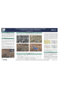
SUPTM 2024 Poster template - Angela Franco.pdf
Assessment of damages from river flooding: principles, methods, and impacts on the territory
Geostatistical comparative analysis of sustainability indicators at urban level