Event submissions
Events2nd Conference on Future Challenges in Sustainable Urban Planning & Territorial Management
Published
This submission belongs to the session GIS. Spatial Analysis of the event 2nd Conference on Future Challenges in Sustainable Urban Planning & Territorial Management
Published date
28 Jan, 2024
Academic Editor
'%3e%3cpath%20d='M12.6657%2010.9104C12.4185%2010.325%2012.0599%209.79327%2011.6097%209.34482C11.1609%208.89508%2010.6293%208.5365%2010.0442%208.28888C10.0389%208.28626%2010.0337%208.28495%2010.0285%208.28233C10.8446%207.69279%2011.3752%206.73249%2011.3752%205.64904C11.3752%203.8542%209.92103%202.39999%208.1262%202.39999C6.33136%202.39999%204.87715%203.8542%204.87715%205.64904C4.87715%206.73249%205.40774%207.69279%206.22393%208.28364C6.21869%208.28626%206.21345%208.28757%206.20821%208.29019C5.62129%208.5378%205.09463%208.89284%204.64265%209.34613C4.1929%209.79493%203.83432%2010.3266%203.58671%2010.9117C3.34345%2011.4845%203.21226%2012.0987%203.20023%2012.7209C3.19988%2012.7349%203.20233%2012.7488%203.20744%2012.7619C3.21255%2012.7749%203.22022%2012.7867%203.22998%2012.7968C3.23975%2012.8068%203.25142%2012.8147%203.26431%2012.8202C3.2772%2012.8256%203.29105%2012.8284%203.30504%2012.8284H4.09109C4.14874%2012.8284%204.19459%2012.7825%204.1959%2012.7262C4.2221%2011.7148%204.62823%2010.7676%205.34617%2010.0497C6.08899%209.30683%207.0755%208.89808%208.1262%208.89808C9.17689%208.89808%2010.1634%209.30683%2010.9062%2010.0497C11.6242%2010.7676%2012.0303%2011.7148%2012.0565%2012.7262C12.0578%2012.7838%2012.1037%2012.8284%2012.1613%2012.8284H12.9474C12.9613%2012.8284%2012.9752%2012.8256%2012.9881%2012.8202C13.001%2012.8147%2013.0126%2012.8068%2013.0224%2012.7968C13.0322%2012.7867%2013.0398%2012.7749%2013.0449%2012.7619C13.0501%2012.7488%2013.0525%2012.7349%2013.0522%2012.7209C13.0391%2012.0947%2012.9094%2011.4855%2012.6657%2010.9104ZM8.1262%207.9024C7.52486%207.9024%206.9589%207.6679%206.53312%207.24211C6.10733%206.81633%205.87283%206.25037%205.87283%205.64904C5.87283%205.0477%206.10733%204.48174%206.53312%204.05596C6.9589%203.63018%207.52486%203.39567%208.1262%203.39567C8.72753%203.39567%209.29349%203.63018%209.71927%204.05596C10.1451%204.48174%2010.3796%205.0477%2010.3796%205.64904C10.3796%206.25037%2010.1451%206.81633%209.71927%207.24211C9.29349%207.6679%208.72753%207.9024%208.1262%207.9024Z'%20fill='%235D1EE1'/%3e%3c/g%3e%3c/svg%3e) Salvador Garcia-Ayllon
Salvador Garcia-AyllonCitation
Francisco Manuel Martínez García, Montaña Jiménez-Espada, Geostatistical comparative analysis of sustainability indicators at urban level, in Proceedings of 2nd Conference on Future Challenges in Sustainable Urban Planning & Territorial Management, 29 January–31 January 2024, MDPI: Basel, Switzerland
Share
Email
Facebook
Twitter
LinkedIn
Geostatistical comparative analysis of sustainability indicators at urban level
'%3e%3cpath%20d='M12.6647%2010.9104C12.4176%2010.325%2012.0589%209.7933%2011.6088%209.34485C11.16%208.89511%2010.6283%208.53653%2010.0432%208.28891C10.038%208.28629%2010.0327%208.28498%2010.0275%208.28236C10.8437%207.69282%2011.3743%206.73252%2011.3743%205.64907C11.3743%203.85423%209.92005%202.40002%208.12522%202.40002C6.33038%202.40002%204.87618%203.85423%204.87618%205.64907C4.87618%206.73252%205.40677%207.69282%206.22296%208.28367C6.21772%208.28629%206.21248%208.2876%206.20724%208.29022C5.62031%208.53783%205.09365%208.89287%204.64167%209.34616C4.19192%209.79496%203.83334%2010.3266%203.58573%2010.9117C3.34247%2011.4846%203.21128%2012.0987%203.19925%2012.721C3.1989%2012.735%203.20135%2012.7489%203.20646%2012.7619C3.21157%2012.7749%203.21924%2012.7868%203.22901%2012.7968C3.23877%2012.8068%203.25045%2012.8148%203.26334%2012.8202C3.27623%2012.8256%203.29007%2012.8284%203.30406%2012.8284H4.09012C4.14776%2012.8284%204.19362%2012.7825%204.19493%2012.7262C4.22113%2011.7148%204.62726%2010.7676%205.34519%2010.0497C6.08802%209.30686%207.07452%208.89811%208.12522%208.89811C9.17592%208.89811%2010.1624%209.30686%2010.9052%2010.0497C11.6232%2010.7676%2012.0293%2011.7148%2012.0555%2012.7262C12.0568%2012.7839%2012.1027%2012.8284%2012.1603%2012.8284H12.9464C12.9604%2012.8284%2012.9742%2012.8256%2012.9871%2012.8202C13%2012.8148%2013.0117%2012.8068%2013.0214%2012.7968C13.0312%2012.7868%2013.0389%2012.7749%2013.044%2012.7619C13.0491%2012.7489%2013.0515%2012.735%2013.0512%2012.721C13.0381%2012.0947%2012.9084%2011.4856%2012.6647%2010.9104ZM8.12522%207.90243C7.52388%207.90243%206.95792%207.66793%206.53214%207.24215C6.10636%206.81636%205.87185%206.2504%205.87185%205.64907C5.87185%205.04773%206.10636%204.48177%206.53214%204.05599C6.95792%203.63021%207.52388%203.3957%208.12522%203.3957C8.72655%203.3957%209.29252%203.63021%209.7183%204.05599C10.1441%204.48177%2010.3786%205.04773%2010.3786%205.64907C10.3786%206.2504%2010.1441%206.81636%209.7183%207.24215C9.29252%207.66793%208.72655%207.90243%208.12522%207.90243Z'%20fill='%235D1EE1'/%3e%3c/g%3e%3c/svg%3e)
Francisco Manuel Martínez García 1

Montaña Jiménez-Espada 1
1. University of Extremadura, Spain
Abstract
Nowadays, a high percentage of the population of the European Union (EU) resides in urban areas, which presents significant challenges for medium-sized cities in Europe. These cities face a complex set of impacts and stresses that require more advanced and coordinated approaches to urban planning and management. Compared to other urban models, European cities show inherent advantages that make them conducive to the implementation of the concept of sustainable development. These advantages are based on compactness, functional structure and the availability of public spaces. Compactness, as a fundamental characteristic of European cities, is evidenced through building density, land use distribution and the proportion of green areas and streets. This parameter influences the proximity between different urban functions and it impacts on mobility, access to public services, the quality of public spaces and the spatial planning model.
The main objective of this research focuses on analysing the formal relationship between urban sustainability and spatial morphology in a Spanish World Heritage city (Cáceres). This fact implies taking into account the urban conditions, the geometric configuration and the distribution of the population in the territory. The methodology employed to carry out this analysis is based on the geostatistical analysis of urban sustainability indicators and standards defined in Law 11/2018 on Sustainable Land and Urban Planning in Extremadura (LOTUS). First of all, a pre-selection of indicators that describe in depth the urban development and sustainability in the study area was performed. The purpose is to analyse the interrelation between sustainability, accessibility and urban context. In order to evaluate these indicators optimally in spatial terms, 75 neighbourhoods that make up the urban core of Cáceres are defined as territorial delimitation units in this research.
After cluster analysis of the variables established, five groups are identified which show particular relationships between them and allow us to establish models that group neighbourhoods with similar characteristics. It is observed that the inner neighbourhoods of Cáceres present a compact model of city, with a high density of population and housing, as well as a high building compactness. In contrast, on the boundaries of the urban core of Cáceres, an urban model based on land consumption is developed, which is unsustainable for the urban environment. As a result, social interactions between the city's inhabitants are reduced and access to the services offered by the city becomes more complicated.
Keywords
Urban planning
GIS
sustainable development
sustainability indicators
medium-sized cities.
Poster
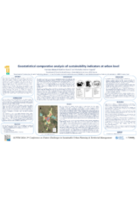
sciforum-081728 Geostatistical comparative analysis of sustainability indicators at urban level (Poster).pdf
Urban policies during the last four decades have influenced the risk of flooding in Cartagena (Spain): A retrospective spatial analysis.
The importance of IoS (internet of services) for urban mobility, with emphasis on the shared bicycle service in the city of São Paulo.