Event submissions
Published
This submission belongs to the session S2. Mineral Systems and Ore Deposits: From Formation to Exploration of the event The 3rd International Online Conference on Mineral Science
Published date
06 Mar, 2026
Academic Editor
'%3e%3cpath%20d='M12.6657%2010.9104C12.4185%2010.325%2012.0599%209.79327%2011.6097%209.34482C11.1609%208.89508%2010.6293%208.5365%2010.0442%208.28888C10.0389%208.28626%2010.0337%208.28495%2010.0285%208.28233C10.8446%207.69279%2011.3752%206.73249%2011.3752%205.64904C11.3752%203.8542%209.92103%202.39999%208.1262%202.39999C6.33136%202.39999%204.87715%203.8542%204.87715%205.64904C4.87715%206.73249%205.40774%207.69279%206.22393%208.28364C6.21869%208.28626%206.21345%208.28757%206.20821%208.29019C5.62129%208.5378%205.09463%208.89284%204.64265%209.34613C4.1929%209.79493%203.83432%2010.3266%203.58671%2010.9117C3.34345%2011.4845%203.21226%2012.0987%203.20023%2012.7209C3.19988%2012.7349%203.20233%2012.7488%203.20744%2012.7619C3.21255%2012.7749%203.22022%2012.7867%203.22998%2012.7968C3.23975%2012.8068%203.25142%2012.8147%203.26431%2012.8202C3.2772%2012.8256%203.29105%2012.8284%203.30504%2012.8284H4.09109C4.14874%2012.8284%204.19459%2012.7825%204.1959%2012.7262C4.2221%2011.7148%204.62823%2010.7676%205.34617%2010.0497C6.08899%209.30683%207.0755%208.89808%208.1262%208.89808C9.17689%208.89808%2010.1634%209.30683%2010.9062%2010.0497C11.6242%2010.7676%2012.0303%2011.7148%2012.0565%2012.7262C12.0578%2012.7838%2012.1037%2012.8284%2012.1613%2012.8284H12.9474C12.9613%2012.8284%2012.9752%2012.8256%2012.9881%2012.8202C13.001%2012.8147%2013.0126%2012.8068%2013.0224%2012.7968C13.0322%2012.7867%2013.0398%2012.7749%2013.0449%2012.7619C13.0501%2012.7488%2013.0525%2012.7349%2013.0522%2012.7209C13.0391%2012.0947%2012.9094%2011.4855%2012.6657%2010.9104ZM8.1262%207.9024C7.52486%207.9024%206.9589%207.6679%206.53312%207.24211C6.10733%206.81633%205.87283%206.25037%205.87283%205.64904C5.87283%205.0477%206.10733%204.48174%206.53312%204.05596C6.9589%203.63018%207.52486%203.39567%208.1262%203.39567C8.72753%203.39567%209.29349%203.63018%209.71927%204.05596C10.1451%204.48174%2010.3796%205.0477%2010.3796%205.64904C10.3796%206.25037%2010.1451%206.81633%209.71927%207.24211C9.29349%207.6679%208.72753%207.9024%208.1262%207.9024Z'%20fill='%235D1EE1'/%3e%3c/g%3e%3c/svg%3e) Theodore Bornhorst
Theodore BornhorstCitation
Fouzia Anzar, Abderrahmane Soulaimani, Mohammed Jaffal, Saïd Ilmen, Walid Kassoui, Structural analysis and identification of hydrothermal alteration using satellite imagery: Implications for ore prospecting in the Proterozoic Bou Azzer–El Graara inlier (Central Anti-Atlas, Morocco), in Proceedings of The 3rd International Online Conference on Mineral Science, 10 March–12 March 2026, MDPI: Basel, Switzerland
Share
Email
Facebook
Twitter
LinkedIn
Structural analysis and identification of hydrothermal alteration using satellite imagery: Implications for ore prospecting in the Proterozoic Bou Azzer–El Graara inlier (Central Anti-Atlas, Morocco)
'%3e%3cpath%20d='M12.6647%2010.9104C12.4176%2010.325%2012.0589%209.7933%2011.6088%209.34485C11.16%208.89511%2010.6283%208.53653%2010.0432%208.28891C10.038%208.28629%2010.0327%208.28498%2010.0275%208.28236C10.8437%207.69282%2011.3743%206.73252%2011.3743%205.64907C11.3743%203.85423%209.92005%202.40002%208.12522%202.40002C6.33038%202.40002%204.87618%203.85423%204.87618%205.64907C4.87618%206.73252%205.40677%207.69282%206.22296%208.28367C6.21772%208.28629%206.21248%208.2876%206.20724%208.29022C5.62031%208.53783%205.09365%208.89287%204.64167%209.34616C4.19192%209.79496%203.83334%2010.3266%203.58573%2010.9117C3.34247%2011.4846%203.21128%2012.0987%203.19925%2012.721C3.1989%2012.735%203.20135%2012.7489%203.20646%2012.7619C3.21157%2012.7749%203.21924%2012.7868%203.22901%2012.7968C3.23877%2012.8068%203.25045%2012.8148%203.26334%2012.8202C3.27623%2012.8256%203.29007%2012.8284%203.30406%2012.8284H4.09012C4.14776%2012.8284%204.19362%2012.7825%204.19493%2012.7262C4.22113%2011.7148%204.62726%2010.7676%205.34519%2010.0497C6.08802%209.30686%207.07452%208.89811%208.12522%208.89811C9.17592%208.89811%2010.1624%209.30686%2010.9052%2010.0497C11.6232%2010.7676%2012.0293%2011.7148%2012.0555%2012.7262C12.0568%2012.7839%2012.1027%2012.8284%2012.1603%2012.8284H12.9464C12.9604%2012.8284%2012.9742%2012.8256%2012.9871%2012.8202C13%2012.8148%2013.0117%2012.8068%2013.0214%2012.7968C13.0312%2012.7868%2013.0389%2012.7749%2013.044%2012.7619C13.0491%2012.7489%2013.0515%2012.735%2013.0512%2012.721C13.0381%2012.0947%2012.9084%2011.4856%2012.6647%2010.9104ZM8.12522%207.90243C7.52388%207.90243%206.95792%207.66793%206.53214%207.24215C6.10636%206.81636%205.87185%206.2504%205.87185%205.64907C5.87185%205.04773%206.10636%204.48177%206.53214%204.05599C6.95792%203.63021%207.52388%203.3957%208.12522%203.3957C8.72655%203.3957%209.29252%203.63021%209.7183%204.05599C10.1441%204.48177%2010.3786%205.04773%2010.3786%205.64907C10.3786%206.2504%2010.1441%206.81636%209.7183%207.24215C9.29252%207.66793%208.72655%207.90243%208.12522%207.90243Z'%20fill='%235D1EE1'/%3e%3c/g%3e%3c/svg%3e)
Fouzia Anzar 1
Abderrahmane Soulaimani 2
Mohammed Jaffal 3

Saïd Ilmen 4
Walid Kassoui 5
1. Faculty of Sciences Semlalia, Geosciences Laboratory, Cadi Ayyad University, Marrakech, Morocco, Morocco
2. Earth Sciences Department, Faculty of Sciences-Semlalia, Cadi Ayyad University, Marrakech, Morocco, Morocco
3. Georesources, Geoenvironment and Civil Engineering Laboratory (L3G), Faculty of Sciences and Techniques, Cadi Ayyad University, Marrakech, Morocco, Morocco
4. CAG2M Research Team, Polydisciplinary Faculty of Ouarzazate, Ibnou Zohr University, 45000 Ouarzazate, Morocco, Morocco
5. ONHYM, Rabat, Morocco, Morocco
Abstract
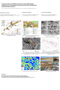
Advanced Spaceborne Thermal Emission and Reflection Radiometer (ASTER) data were used to investigate structural features and hydrothermal alteration zones for mineral exploration in the Precambrian basement of the Bou Azzer–El Graara inlier, located in the Moroccan Central Anti-Atlas. This domain, recognized as a Pan-African suture zone, contains a complex accretionary mélange of arc-related terranes and dismembered supracrustal ophiolites hosting economically significant mineralizations such as Co, Au, and Cu. Its arid setting offers favorable conditions for satellite remote sensing to detect lineaments and alteration patterns indicative of potential metal resources.
To refine structural mapping of the study area, key lineaments were extracted from ASTER data and compared with existing geological interpretations. The identified NE–SW and E–W fault families are consistent with previous tectonic studies, confirming their strong control on the spatial distribution of mineralization. In addition, previously unmapped faults were revealed, requiring further field verification but providing valuable insights into the region’s complex geodynamic evolution. Many of these structures correspond to faults reactivated during the Pan-African, Variscan, and Alpine–Atlas tectonic events.
In the second part of this study, ASTER surface reflectance data were used to map hydrothermal alteration zones through targeted band ratios, enabling the identification of iron oxides, hydroxyl-bearing minerals, sulfates, and carbonates. When combined with available geochemical information, the results show that cobalt anomalies correlate with carbonate–chlorite–epidote alteration, gold anomalies with alunite–kaolinite–pyrophyllite and locally sericite–muscovite–illite–smectite assemblages, and chromium and nickel anomalies with both carbonate–chlorite–epidote and sericite–muscovite–illite–smectite alteration types.
Overall, this integrated approach improves structural and alteration mapping and provides valuable guidance for future mineral exploration in the Bou Azzer–El Graara inlier.
Keywords
Remote sensing
Aster images
Hydrothermal alteration
Mineral mapping
lineaments analysis
Bou Azzer-El Graara inlier
Anti-Atlas
Morocco.
Poster
Poster_Anzar_Remote_Sensing_BouAzzer.pdf
Novel Sustainable Process for the Recovery of Aluminium and Rare Earth Elements from High-Silica Bauxite
Optimization of Ultrafine Grinding Parameters Guided by Process Mineralogy to Improve Iron Separation Efficiency of titano-magnetite in Magnetic Separation