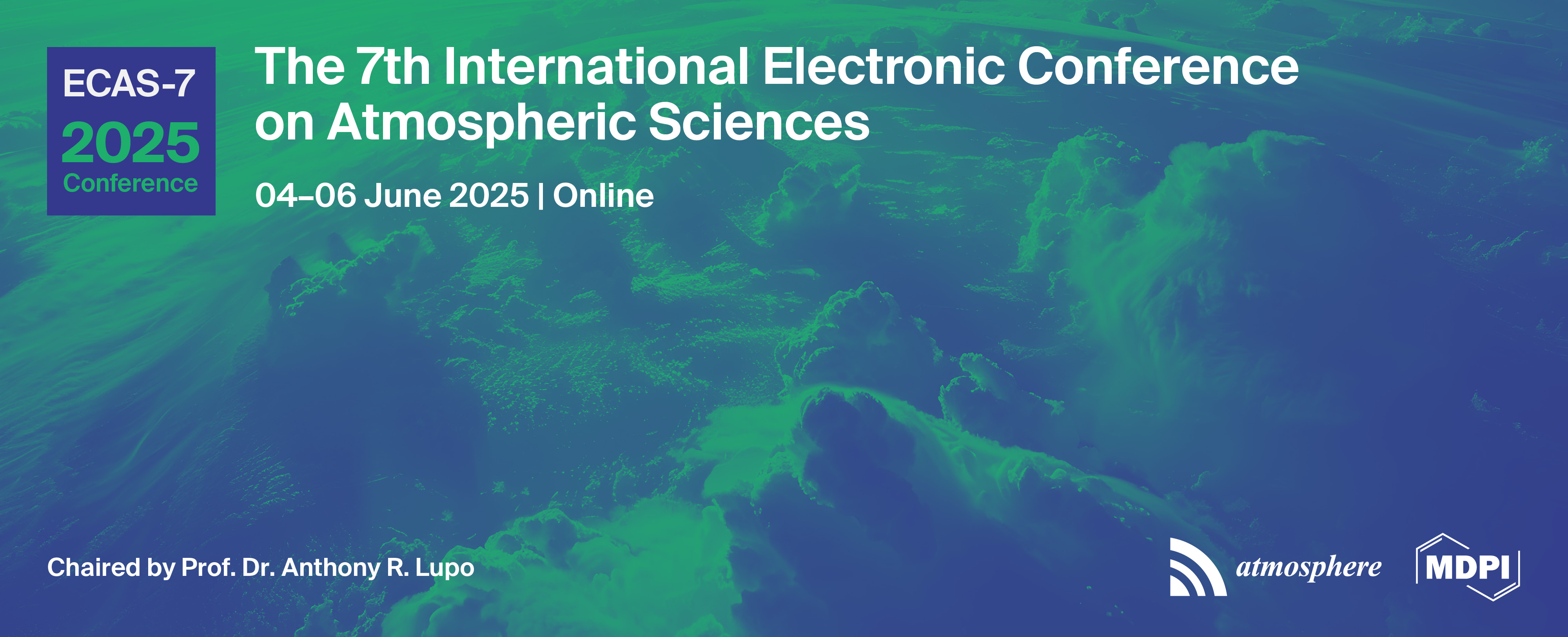
Please login first

List of accepted submissions


Show results per page
Find papers
 
  • Open access
  • 0 Reads
Assessment of Climate Variability and Trends in Water Availability in South America

This study examines the climatic water availability, defined as precipitation minus potential evapotranspiration (PET), in continental South America during historical (1960–2014) and future (2015–2100) periods. Observed (CRU TS, ERA5) and modeled (CMIP6) data were used, with future projections under the SSP2-4.5 and SSP5-8.5 scenarios derived from an ensemble of five models best representing the continent. To improve the drought analysis, the SNIPE (Standardized Nonparametric Indices of Precipitation and Evaporation) methodology was applied. This method aggregates the data over multiple time scales (1, 3, 6, and 12 months) and uses nonparametric rescaling to produce standardized indices (zero mean, unit variance). Unlike the SPI and SPEI indices, which rely on parametric assumptions that may bias the results if the data deviate from the assumed distributions, SNIPE uses a distribution-free approach, making it a robust tool for drought assessment. Historical data from both the observed and modeled sources show similar water availability patterns: drought in Patagonia, the Atacama, the Central Andes, and the Brazilian northeast and high availability in the Amazon and southeast Brazil. Future projections indicate an expansion and intensification of drought, mainly affecting transition zones such as the Brazilian Cerrado, the edges of the Amazon, the Chaco, and the semiarid areas of the Brazilian northeast, with more pronounced changes under SSP5-8.5. Correlation analyses between SNIPE and various climate indices (AMO, ONI, PDO, SAM, TNA, TSA, and TPI-IPO) reveal that indices such as TPI-IPO, ONI, and TSA play key roles in the water regime dynamics in southeastern South America (including the areas of southern/southeastern Brazil, Paraguay, Uruguay, and northeastern Argentina), a region frequently impacted by floods. These findings underscore SNIPE’s potential to enhance forecasting systems and water resource management strategies.

  • Open access
  • 0 Reads
Assessment of Urban Air Quality in Salé, Morocco: An In-Depth Analysis of PM2.5 Seasonal Variations, Elemental Composition, and Enrichment Factors

Sale, situated along the Atlantic Ocean, ranks as the third-largest city in Morocco, characterized by its high demographic density and significant air pollution challenges. The Bouregreg River delineates Sale from Rabat, the capital of Morocco. Key sources of air pollution in Sale include traffic emissions, maritime activities, potteries, fishing, domestic heating, and artisanal operations. From July 2018 to July 2019, we conducted a comprehensive study on ambient PM2.5 concentrations in an urban area of Sale. Using a Dichotomous sampler, we collected PM2.5 samples and employed Total X-Ray Fluorescence to analyze the elemental composition of the collected filters. The results indicated that PM2.5 mass concentrations fluctuated between 3.08 μg/m³ and 49.48 μg/m³, with an average of 17.30 μg/m³. Notably, peak concentrations occurred during winter months, contrasting with lower levels observed in summer. To investigate the influence of atmospheric transport on PM2.5 levels, we applied the HYSPLIT™ model for air mass back-trajectories analysis, identifying four primary transport clusters arriving at the monitoring site in Sale: Iberian Coast (24%), Near Atlantic Ocean (33%), local sources (28%), and Oceanic influences (15%). Seasonal analysis revealed variations in metal concentrations. Elements such as K, Ca, V, Mn, Fe, Ni, Cu, Zn, As, Sr, Ba, and Pb showed elevated levels during winter, while Ti and Cr peaked in autumn. Enrichment Factor (EF) assessments indicated that Ti, Sr, Mn, K, Ca, and Ba predominantly originated from airborne dust (EF < 10). Meanwhile, V, Cu, and Cr exhibited both natural and anthropogenic contributions (10 < EF < 100), while Ni, Zn, and Pb were largely anthropogenic (EF > 100). According to the Morocco National Ambient Air Quality Standard, the annual mean limit for PM2.5 is set at 35 µg/m³, indicating that the average PM2.5 concentration of 17.30 µg/m³ observed in Sale is below this limit, suggesting that while air quality is better than the standard, seasonal spikes could still pose health risks.

  • Open access
  • 0 Reads
Issues and challenges around classification of respiratory sensitizers/allergens in the United Nations Globally Harmonized System

Introduction

The United Nations Globally Harmonized System (GHS) of classification and labelling provides specifications for the classification, management, and communication of hazards, crucial for protecting workers and consumers. However, issues and challenges exist in its application, particularly concerning respiratory sensitizers, many of which can become airborne pollutants in occupational settings and in broader environments, where they may engulf entire regions.

Methods

This is a narrative review that assesses relevant GHS documents and internationally accepted methods for determining respiratory sensitizers.

Results

Chemical sensitization is complex and depends on factors like allergen nature, dose, and exposure route, including inhalation. Sensitization initially involves the induction of specialized immunological memory in an individual by exposure to an allergen, followed by elicitation, which is the production of an allergic response following exposure of a sensitized individual to an allergen. Consequently, predictive tests also involve both induction and elicitation, followed by classification as Category 1, 1A or 1B, depending on the evidence. Unfortunately, GHS classification relies heavily on epidemiological data captured retrospectively with diagnostic testing rather than on prospective (predictive) data. Moreover, there are issues regarding the potency of chemicals and absence or presence of no-adverse-effect levels (NOAELs). Accurately assessing airborne exposure to sensitizers can be challenging, especially in complex environments, making it difficult to establish clear dose–response relationships. Lastly, the potential for certain respiratory sensitizers to become airborne and persist in the atmosphere increases the risk of prolonged inhalation exposure, underscoring the necessity for accurate GHS classification.

Conclusion

Challenges exist in interpreting results and accurately classifying sensitizers, potentially underestimating risks associated with airborne exposure. Users of GHS SDSs and labels must be aware of these limitations, particularly concerning inhalation exposure and potential airborne pathways. Further research is needed to improve GHS classification and understanding of the atmospheric behavior of sensitizers.

  • Open access
  • 0 Reads
Influence of Quasi Biennial Oscillation(QBO) on tropical cyclones in North Indian Ocean from 1979 to 2017

This study investigates the occurrence of tropical cyclones in the North Indian Ocean region, examining the influence of solar activity on the Quasi-Biennial Oscillation (QBO) and El Niño-Southern Oscillation (ENSO). The primary objective is to assess the impact of QBO and ENSO on tropical cyclone formation. The equatorial QBO anomaly is analyzed across pressure levels ranging from 10 hPa to 70 hPa, with a particular focus on 30 hPa, using data from the Freie Universität Berlin. To establish a correlation, a normalized occurrence rate of tropical cyclones was derived following the methodologies of Sonnemann and Grygalashvyly (2007) and Ekaterina Vorobeva (2019).

Between 1979 and 2017, a total of 389 tropical cyclones formed in the North Indian Ocean, specifically in the Bay of Bengal and the Arabian Sea. This study primarily examines cyclonic activity during the pre-monsoon (May–August) and post-monsoon (October–December) seasons, utilizing data from the India Meteorological Department (IMD). The results indicate that tropical cyclones predominantly occur during the easterly QBO phase, with 24 out of 39 years exhibiting easterly winds and 15 years experiencing westerly winds.

Statistical analyses, including regression analysis, correlation coefficients, and tests of statistical significance, reveal a strong positive correlation between QBO and tropical cyclone activity. Specifically, a correlation coefficient of 0.7 suggests a significant association between QBO variations and cyclone occurrence in this region.

  • Open access
  • 0 Reads
Correlation Between Hair Element Concentration, Sex, and Body Mass Index in Young Italian Population

Introduction

Human hair is an excellent biological indicator for assessing human health conditions. It can provide an indication of mineral levels and accumulation of toxic metals resulting from long-term or acute exposure. This study investigates the relationship between the concentration of toxic elements in hair and Body Mass Index (BMI) in adolescents with no environmental or occupational exposure. The latter physiological factor influences the metabolism of both essential and toxic elements in the human body, providing a valuable diagnostic framework for various diseases.

Methodology

Instrumental Neutron Activation Analysis (INAA) was used for a highly sensitive and accurate element determination. The collected samples were pre-treated with acetone and drying before the analysis.

Results

The results obtained suggested the abundance of zinc (Zn) (100 µg g-1), followed by iron (Fe), and copper (Cu), all with concentrations above 1µg g-1. A weak positive correlation was found between Zn and K, while magnesium (Mg) levels proportionally increased with BMI (173±129 µg g-1; 24.0 <BMI < 25.4). Further statistical analyses, including cluster analysis and principal component analysis, suggested low similarity between sulphur (S) and chlorine (Cl), which were indirectly associated with BMI. The data obtained have been studied and discussed with data from an inorganic fraction of particulate matter, PM10 and PM2.5, registering very low levels of the elements investigated (As = 1.06 ng m-3, Cr = 3.3 ng m-3, and Ni = 3.5 ng m-3 in fine granulometric fractions).

Conclusion

The results provide an important basis for assessing the effects of anthropogenic phenomena, such as atmospheric emissions, in urban areas. Although no significant correlations with BMI were found for any of the elements studied, the findings represent a baseline for further and more comprehensive understanding of the mechanisms of the accumulation or release of toxic elements in the bodies of individuals exposed in relation to BMI.

  • Open access
  • 0 Reads
Py-GC-MS for determining Microplastic Release from Take-Away Containers

Introduction

This research study examines the release of microplastics from containers made of three different polymer types, such as polypropylene (PP), polystyrene (PS), and polyethylene terephthalate (PET).

Methods

Experiments were conducted by simulating three different conditions by which foods could be delivered. Milli-Q water at room temperature, 100 °C, and pH 4.5 were used for the experimental tests. To simulate the transport, containers were exposed for 20 minutes to milli-Q at room temperature, 100 °C Milli-Q water, and slightly acidified water with agitation at 10 rpm. Then, water solutions were filtered using a Whatmann Glass Fiber Filter, with a pore size of 1.6 µm, for microparticle recovery. Microparticles were quantified using optical microscopy. The same experimental conditions were replicated for micro-Raman analyses, using stainless-steel frits (0.2 μm), due to the low background. This approach was used to confirm the polymeric composition of the particles.

Results

The findings reveal that PET and PS containers released microplastics in varying amounts: 9 and 1 particles at room temperature, 7 and 3 in acidic conditions, and 17 and 30 at 100 °C, respectively. The detected particles measured between 13 and 32 μm. Notably, no microplastic release was observed from PP containers under any tested conditions.

Conclusions

These results highlight the significant microplastic release from PET and PS containers. These findings have great environmental implications. The release of microplastics from plastic containers raises concerns not only for direct human ingestion but also for their potential to become airborne contaminants. Microplastics in food may be subjected to evaporation, aerosolization, or mechanics, facilitating their transfer into the air. Given their small size, these particles could be inhaled, contributing to atmospheric microplastic pollution. These findings highlight the need for further research on the airborne dispersal pathways of microplastics from food packaging and their broader environmental and health implications.

  • Open access
  • 0 Reads
The Air Pollution Impacts of California's 2018 Wildfires

Wildfires emit large quantities of air pollutants into the atmosphere and are emerging as a significant global threat. As global warming increases the frequency, intensity, and duration of wildfires, the resulting air pollution also increases. This study investigates the role of meteorological conditions and topographical features on the three-dimensional transport and distribution of PM2.5 during California's unprecedented 2018 wildfire season, with a particular focus on two major wildfires: the Mendocino Complex Fire and the Camp Fire. Multiple data sources, such as EPA ground monitoring stations, MODIS satellite products, and HYSPLIT trajectories, were integrated to analyze the horizontal and vertical pollutant transport patterns. The results revealed that persistent low-pressure systems and weak winds (≤2 m/s) created pronounced atmospheric stagnation, leading to pollutant accumulation near the surface. An analysis of PM2.5-AOD (Aerosol Optical Depth) correlations demonstrated stronger relationships during wildfire events compared to baseline periods, indicating the significant role of the wildfire-induced aerosols throughout the atmospheric column. HYSPLIT back trajectory analysis during peak pollution episodes revealed that while air masses originated from the Pacific Ocean, they remained confined to lower atmospheric layers (below 1.5 km), exacerbating surface-level pollution. Due to these conditions, the Camp Fire, despite its shorter duration, demonstrated more severe air quality impacts than the larger Mendocino Complex Fire, highlighting the significant role of burning intensity and meteorological conditions in pollution transport.

  • Open access
  • 0 Reads
Quantifying Urban Air Quality Across Global Megacities

This study aims to understand the trends in air pollutant concentrations across five megacities, Shanghai, Delhi, Paris, Los Angeles, and São Paulo, from the year 2018-2020. Relevant Air Quality Data for PM2.5, PM10, O3, NO2, and SO2 were obtained from sources such as the World Air Quality Index and the U.S. Embassy and Consulates’ air quality monitors, and compared with various meteorological elements to ascertain the annual and seasonal trends in air quality. The findings revealed significant variations in key pollutants such as PM2.5, PM10, Ozone (O3), Nitrogen Dioxide (NO2), and Sulfur Dioxide (SO2). According to our findings, Shanghai exhibited an overall decrease in PM2.5 and SO2 levels over the period, while concentrations for O3 and PM10 remained stable. Delhi showed significant seasonal fluctuations in PM2.5 and PM10 levels, with the highest pollution levels during the paddy burning season and the lowest during the monsoon season, with a notable reduction in NO2 and SO2 concentrations, reflecting better vehicular and industrial emissions standards. Paris displayed a clear downward trend in PM2.5, PM10, and NO2 levels, exhibiting the effectiveness of their measures in reducing emissions from vehicle and industrial sources.

PM2.5 and PM10 levels in Los Angeles showed slight variations throughout the year with sudden unexpected peaks in air pollution, with a consistent decline in NO2 and SO2 concentrations, indicating improved air quality management. São Paulo showed variability in PM2.5 and NO2 levels, while O3 concentrations fluctuated, reflecting the complexities of urban pollution control. This study highlights the impact of regulatory measures, industrial activities, and meteorological conditions on air quality, and emphasizes the importance of continuous monitoring and effective pollution control strategies.

  • Open access
  • 0 Reads
A SPATIOTEMPORAL ANALYSIS OF THE OCCURRENCE OF FIRES IN THE CAATINGA BIOME: A CLIMATOLOGICAL APPROACH USING MACHINE LEARNING

The Caatinga is a semi-arid forest biome with a climate that is marked by severe droughts and recurrent fires, resulting in a loss of biodiversity. This research uses daily data from the VIIRS active fire detection product (onboard the S-NPP and NOAA-20 satellites) to analyze fires from 2012 to 2023 in the Caatinga Biome, where the data set was filtered, including only Fire Radiative Power (FRP) values above zero and considering only detections that were longer than 24 hours. The clustering methodology of Nascimento et al. was then applied, using the DBSCAN algorithm to identify and group the fires. The latitude, longitude, and time coordinates were transformed into a common Cartesian space, allowing for the identification of patterns in the distribution of fires, in which unique identifiers, called “fire_id”, were used to identify the frequency, duration, and intensity of these fires. The climatology of the FRP and Fire Radiative Energy (FRE) data showed significant variability, especially from July onwards, where the highest climatological averages of the FRP occurred in November (~17 MW/h) and October (~16 MW/h), respectively. The highest climatological averages of the RES occurred in August (300.000 MJ) and September (200.000 MJ), respectively. The annual distribution showed FRP peaks throughout all years, with a significant increase in 2021 (~1500 MW/h), but the highest frequency of fire_id markers was recorded in October 2023 (7455). In addition, the highest fire_id frequencies occurred mainly in the months of September to November. A kernel density analysis, which mapped the spatial distribution of the FRP density, showed that the states of Bahia and Piauí had the highest FRP intensities, indicating a significant concentration of fires in these regions. These results contribute to the development of prevention and mitigation strategies, both in the short and long term.

  • Open access
  • 0 Reads
AN ANALYSIS OF FIRE DYNAMICS IN THE STATE OF ALAGOAS AND THEIR RELATIONSHIP WITH METEOROLOGICAL VARIABLES

Studies that address the dynamics of fires in the state of Alagoas and their relationship with meteorological conditions remain scarce, especially ones that use Machine Learning in their methodology. Thus, to analyze the spatiotemporal dynamics of fires in the state of Alagoas and their relationship with meteorological variables, daily data from the VIIRS active fire detection product (on board the S-NPP and NOAA-20 satellites) were used to analyze fires from 2012 to 2023 in the state of Alagoas. The dataset was filtered, including only Fire Radiative Power (FRP) values above zero and considering only detections that were greater than 24 hours. Subsequently, the clustering methodology of Nascimento et al. was used, using the DBSCAN algorithm to identify and group fires. To analyze the behavior of meteorological variables, a range of ERA5 reanalysis variables were used. The results showed significant variability in the climatology of the FRP and Fire Radiative Energy (FRE), where the highest FRP averages occurred in the months of October to March, with the highest records occurring mainly in January (~10 MW/h), February (~9 MW/h), March (~9 MW/h), and December (~9 MW/h). During these months, the climatology of temperature at 2 meters presented the highest records, mainly in the sertão (~37°C). In addition, the climatology of relative humidity varied between 0 and 50% throughout these months in the sertão, coastal, and forest zone regions. The climatology of the FRE presented the highest averages in the months of November (~9000 MJ) and December (~8000 MJ), where the highest records of wind speed were obtained, mainly on the coast and in the forest zone (~6 m/s). The highest concentrations of FRP and FRE and the longest stretch of days of fires occurred on the coast and in the forest zone.

Top